
Appalachian Trail Project in VA – 7/20/14 – Rice Field
Shelter Southbound to Pearisburg – 7 Miles

Heavy rain poured down during the night and I was surprised to find water seeping inside my tent. Maybe I didn’t have my plastic footprint folded up underneath the tent edge properly. Anyway, at 2:00 a.m. I was sopping up water with my bandana, reaching out of the tent door to squeeze it out, sopping some more. Not a pond, but a puddle that came too close to my sleeping bag. Needless to say, not much sleeping going on after that.
By sunrise the rain had ceased – but for how long? I stuffed my wet tent and footprint into a
garbage bag and strapped it to the outside of my backpack. Then I packed up my wet everything else, said
goodbye to Mike, who was cooking up his usual hot oatmeal breakfast, and I
stepped onto the trail southbound. It
was still chilly and wet, but I had crossed fingers that things would clear up
and heat up (yes on both counts). It
turned out to be a beautiful day.
As I mentioned, the new reroute of the AT starts right at
the shelter, following the former water source trail, descending steeply down
the eastern side of Peters Mountain. The old trail continued along the ridge line with a few more good viewpoints,
but the reroute is a welcome improvement for protection of the trail. Roughly the same length as the former (maybe
half a mile shorter) and a little more moderate grade, the new trail is located
on land donated by the chemical manufacturer Celanese. Prior to this the trail passed along tenuous
easements between Celanase and inhospitable private landowners. The reroute is the result of many years of
negotiations and work involving the Appalachian Trail Conservancy, the U.S.
Forest Service, a couple of Virginia senators, multiple trail building crews,
and Celanese and Columbia Gas. The section
was officially opened in May 2014. There
are no published route revisions yet but here is a good blog post with
information.

Excellent trail work on the new section descending Hemlock
Ridge

Brand new trail
I put my trust in following white blazes since I had no
notes on the route. Several times the
trail crossed or ran a few dozen yards concurrently with unpaved forest
roads. Blazes were excellent so I never worried about
where I was going.


Brunch break at a road crossing
The trail passes near the Celanese landfill, marked by a
chain link fence. Made me feel like I
was close to the end, but there were still a couple of miles to go as the trail
switchbacked down. (Note: Don't use any water sources from here on down)


The new trail connects with the old one within about 100
yards of Highway 460. The Celanese plant
is across the highway.

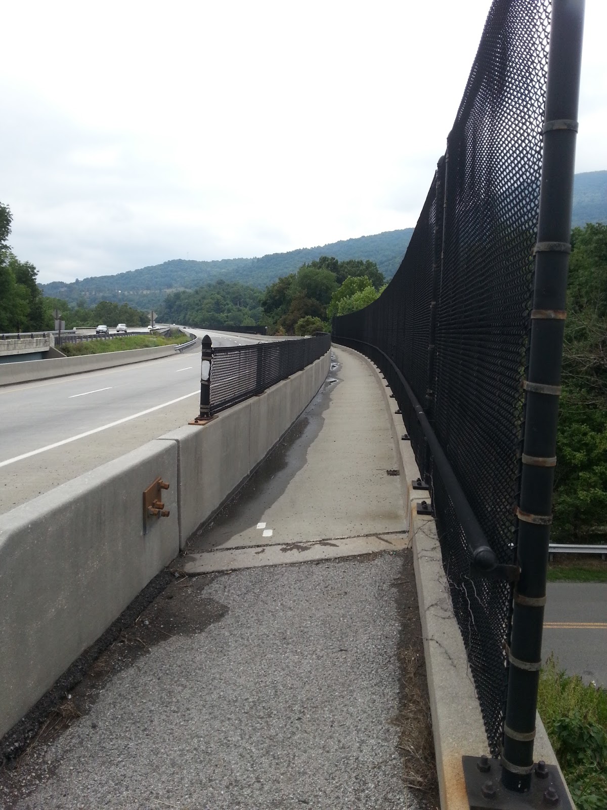
Following the blazes across a parking lot to a stairway

Up we go
And the white blazes continue on a pedestrian walkway across
the New River. From there the trail
turns right into the woods and through those back yards that I passed coming the
opposite way yesterday. For me, I
crossed four-lane 460 to my car to wait for Mike (not far behind). What a great feeling to have this gap filled
in!
“Give me once more a trail I know
That stretches back through the long ago
And yet leads on through the future’s veil
In search of tomorrow’s untrod trail.”
That stretches back through the long ago
And yet leads on through the future’s veil
In search of tomorrow’s untrod trail.”
~Earl Shaffer
No comments:
Post a Comment