
Appalachian Trail Project in VA - Shenandoah National Park –
10/27/13 – Turk Gap to Loft Mountain Campground - 17 Miles
Good news! The government
got over its hissy fit, America’s public lands reopened and people swarmed in,
although the leaves were past their peak in many areas and the revenues lost to
local economies were gone forever. Jim
and I attended yet another Virginia Tech football game on Saturday and left B’burg
on Sunday morning at dark-thirty to get to Shenandoah National Park. I had an ambitious 3 days of Appalachian Trail hiking planned, starting
with a 17-mile trek from Turk Gap northbound to the Loft Mountain Campground store.
Brief facts about Shenandoah National Park:
·
- Established in 1935, similar to Great Smoky
Mountains NP in that hundreds of families were displaced to make way for the
park
·
- Over 500 miles of trails, including 101 miles of
the AT
·
- Includes 300 square miles of the Blue Ridge
Mountains
·
- Total acreage is 196,466 acres
·
- Park website says there are between 300 and 500
black bears – the upper range gives about the same density of black bears as in
Great Smoky Mountains NP
·
- Skyline Drive, beginning at the northern end of
the Blue Ridge Parkway, runs up the spine of Shenandoah, providing access to all
campgrounds, lodges and attractions.
Last-minute check in the parking lot: water, food, camera, hiking poles, gloves, hat. I wasn’t too worried, though, because I knew I’d
cross Skyline Drive six times and could always hitch a ride if I needed to bail
out. I waved goodbye to Jim as he
prepared for his bike ride and then I melted into the woods.
Five minutes later, I began to hear odd sounds, sort of low
moaning like a sick cow, or like a person imitating a sick cow. Funny, I don’t remember reading about any open
pasture land, and anyway, I’m inside the national park boundary. Is there a person trying to startle me? I turned 360 degrees, couldn’t see any
movement, but the trees were swaying. Was
I hearing two trees rubbing together?
Hey…what is that big black spot…three big black spots…up in the tree
over there?
It’s a mama bear and two very large cubs. I think the cubs were crying (or maybe enjoying themselves) because the trees were swaying precariously with the wind and their weight. How did they get that far up anyway? And do they see me?
It’s a mama bear and two very large cubs. I think the cubs were crying (or maybe enjoying themselves) because the trees were swaying precariously with the wind and their weight. How did they get that far up anyway? And do they see me?

Feeling brave at a safe distance, I began snapping pictures
with both my camera and my phone.
Suddenly mama bear decided to descend and reached the ground in barely
the blink of an eye. Immediately I
turned away and headed up the trail at a quick clip – not running – with my
ears primed for any sounds behind me. I
frequently looked back over my shoulder for ten minutes or more as I hiked away
from the area, but the bears did not reappear.
Well, that was the first few minutes of the day. What else is in store?

The rest of the day was uneventful for wildlife at least. But how about this enormous leaf?

Red-orange bittersweet berries are the most colorful thing
in the woods now

Criss-crossing Skyline Drive
The geological highlight was Blackrock, which the AT loops nearly three-quarters of the way around to make sure you don’t miss it. It is also easily accessible via a half-mile trail from a parking area on Skyline Drive. Blackrock is a pile of talus rock – Hampton Sandstone, which someone more knowledgeable than I will have to elaborate on -- just begging to be scrambled (there is no “trail” to the top of the pile). However, it’s not as easy as it looks. Some rocks are loose, even the big boulders are wiggly, and an ankle-twisting may await you.

There were people around but somehow no one played “King of
the Mountain” while I was up top. The view
is 360 degrees. Imagine how glorious it
would have looked a couple of weeks earlier when the leaves were in full color.


On top of Blackrock

Lichen patterns on the rocks
The waypoints were frequent, the miles churned out, and by
the time I reached the first sign for Loft Mountain Campground I was ready to
call it a day. But…although there were
several connector trails going through the campground, if you want to pass
every white blaze, the AT circumvents it and winds all the way around the
south, the east and up to the northern end.
There is where I found the connector trail to the camp store. Swiftly I hiked up this little path a bit
ahead of schedule, ready to buy a soft drink and check off the day’s progress.
No cars. Not mine or
anyone else’s. The place was shut up
tight.
My sad conclusion was that the campground was closed for the
season and the access road was gated so Jim couldn’t get in to leave the
car. I didn’t have the guidebook or
larger maps with me, just my elevation profile notes, so I tried to remember
details of the brochure we had picked up when we entered the park. Seems like the paved road goes down just a
mile or so to join Skyline Drive.
Hopefully Jim parked as close to that road junction as possible. Nothing for it but to walk a little longer.
Ah, yes! At the
junction with Skyline Drive sits Loft Mountain Wayside, a little gift shop and
restaurant, and that’s my car in parking lot!
But Jim is not in it…but his bike is… he must have gone looking for me.
I waited a while as I tried to reason what Jim would
do. He must have thought he could
intercept me by hiking up the spur trail that started by the campground access road
and goes up to the AT. But when? It couldn’t have been too long. If he took the trail and I took the road, we
would have missed each other. As I
puzzled, I saw a car turn onto the campground access road, open the gate and
leave it partially open. Choosing to beg
forgiveness rather than permission, I followed in my car back up to the campground
store. Now there was a cleaning crew there and, yes, they had just spoken to Jim and sent him on up the AT
to look for me.
Cut to the chase:
after two hours of me driving to different AT access points along
Skyline Drive, leaving notes to tell Jim to stay put and talking to everyone I
saw to intercept him, we were reunited at the Wayside. I was mainly worried that he would go too far
south on the trail, worry that he wasn’t finding me, and darkness was descending. Once we were both accounted for and parsed
the sequence of events and Jim’s good intentions, the moral of the story was
not to ever come looking for me until I am overdue by an agreed amount of
time. The vast majority of the time I
can figure things out for myself.
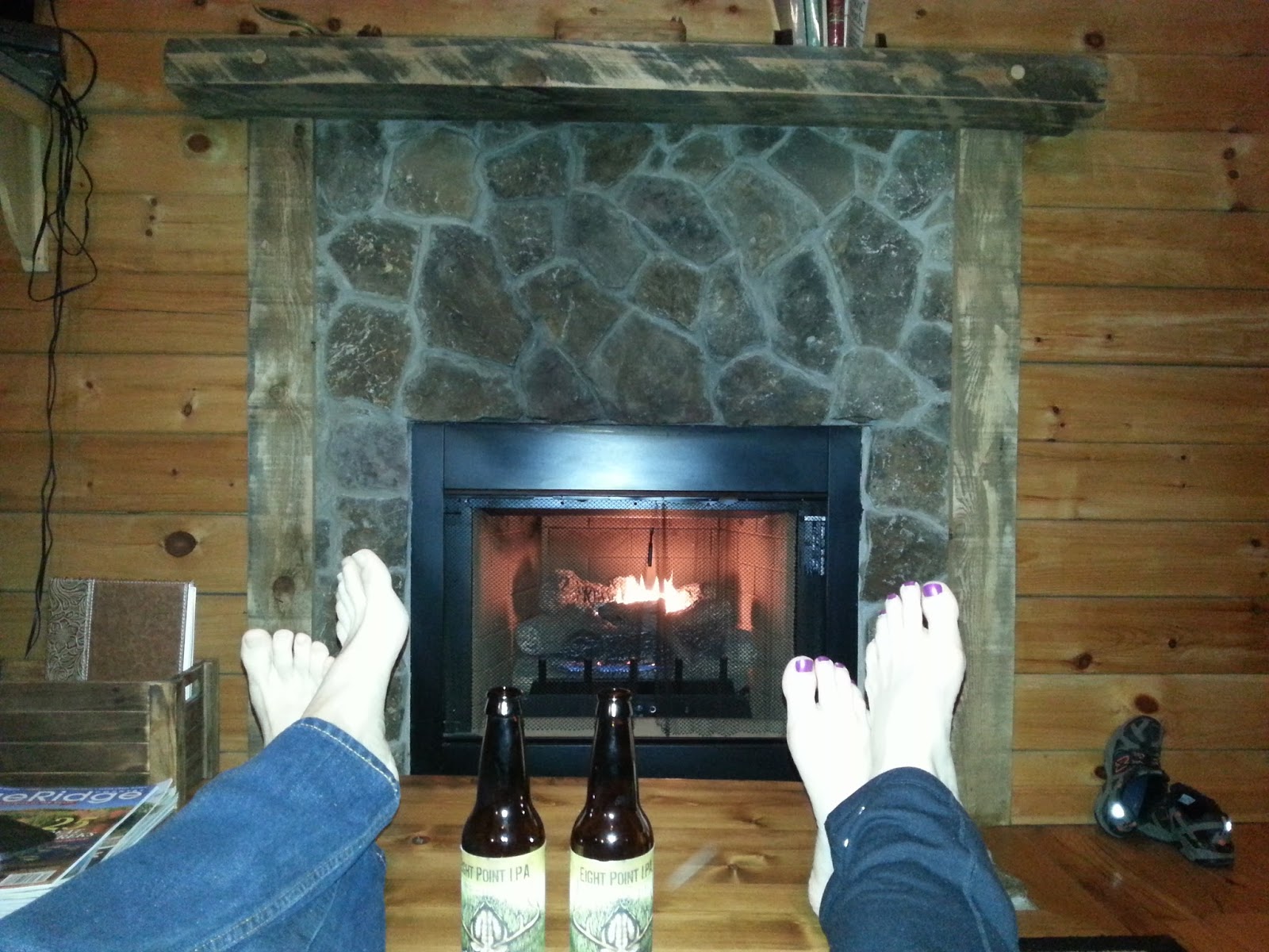
The happy ending was our lovely secluded cabin at Lydia Mountain Lodge & Cabins called "Just Us." The owners very graciously allowed us to change
our reservation for early October without a fee. A home-cooked meal, a beer, a hot tub
and a warm fire made everything all better.
[Footnote: My hike took place in October 2013, but shortly
before this posting in March 2014, this area was devastated by a fire encompassing
more than 450 acres, reportedly started by an illegal campfire. The AT and Skyline Drive remain open but the
Wildcat Ridge and Rocks Mountain side trails to the west are closed.)
Wine is constant proof that God loves us and loves to see us happy.
Read more at http://www.brainyquote.com/quotes/keywords/wine.html#omyhm8lTX86ThGHe.99
Read more at http://www.brainyquote.com/quotes/keywords/wine.html#omyhm8lTX86ThGHe.99
Wine is constant proof that God loves us and loves to see us happy.
Read more at http://www.brainyquote.com/quotes/keywords/wine.html#omyhm8lTX86ThGHe.99"I may not be there yet, but I'm closer than I was yesterday." ~Author Unknown
"I may not be there yet but I'm closer than I was yesterday." ~Unknown
Read more at http://www.brainyquote.com/quotes/keywords/wine.html#omyhm8lTX86ThGHe.99"I may not be there yet, but I'm closer than I was yesterday." ~Author Unknown
1 comment:
Wow! Very exciting to see a mama bear and cubs (and yes, I'm sure a little bit scary too). Glad you and your hubby were reunited okay. Sorry to hear this beautiful area was devastated by a forest fire. I'd really love to get out this way someday and hike some of these beautiful trails!
Post a Comment