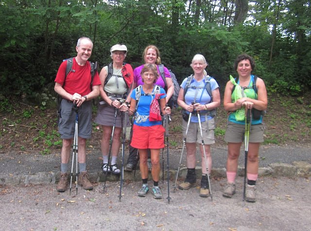
Appalachian Trail Project in VA – 8/3/13 – Thunder Ridge
Overlook at BRP 74.7 Southbound to Jennings Creek – 15.4 Miles
Now back to our regularly scheduled hiking program – the Appalachian
Trail in Virginia
The drive to central Virginia is 4+ hours, too far for a
dayhike. Maximizing short weekend hours
is important, especially if you want to avoid time off from the day job. Cathy suggested a one-night plan for the
28-mile stretch between Jennings Creek and the James River, a tough section
with a shelter at the midpoint, which is also the highest point.
Hey, wait a minute….looking at the map, the
Blue Ridge Parkway intersects the AT at about the same point. Could we just park a shuttle car there and
hike up without loaded backpacks and then drive to some nice campsite? And then set up a shuttle from there the next
day to finish the section?
And hey, wait another minute…if we use paid shuttle drivers,
we can save ourselves a lot of time each day.
AND…we can start at that high point EACH DAY, hiking southbound on Day 1
and northbound on Day 2, downhills both days.
Yes! Without backpacks!
And hey, wait one more minute…we can camp at that sweet
little hidden spot beside Jennings Creek that we discovered last month – free –
if we get there early enough to claim it.
What a fantastic way to end the day with a dip in the creek (as Cathy,
Becky and I well knew) and then walk to our campsite and enjoy supper. We are geniuses.
Six people joined in the trip: Andy (new to me), Becky, Tamara (new to all
of us), Cathy, me and Chris.
[Disclosure: Tamara signed up for
the original backpack scenario, then attempted to bail out when it became “car
camping with a potluck supper,” then joined back in when we assured her that
the hiking part would not be easy. I
think we were proven right.]
With a very early start from Charlotte on a Saturday morning,
we arrived at Jennings Creek and found our dream campsite empty, so we set up
our tents. Our good friend Homer met us
to shuttle to the midpoint. We were
itching to get going, a 15-mile hike in front of us and starting at almost
noon.
Pretty summer flowers from the start
Cow parsnip
Coreopsis
Foxglove
Only a mile-and-a-half into the hike we came to Thunder Hill
Shelter sitting directly by the trail – a good stop for lunch.
Walking under a precarious-looking boulder called the
Guillotine. Imaginative trail builders probably
had a good laugh routing the trail to pass under this.
Passing the FAA tower on Apple Orchard Mountain. This is the highest point on the AT between Clingman's Dome in NC (600 miles south) and the White Mountains in NH (1000 miles north). It was a hot and hazy day. In looking over the photos after a hike, I am often surprised to see ominous clouds. I don’t notice them when we’re hiking.
Passing the FAA tower on Apple Orchard Mountain. This is the highest point on the AT between Clingman's Dome in NC (600 miles south) and the White Mountains in NH (1000 miles north). It was a hot and hazy day. In looking over the photos after a hike, I am often surprised to see ominous clouds. I don’t notice them when we’re hiking.
Andy on the trail – lush vegetation everywhere
Jewelweed
Stunning view from Black Rock Overlook
Tree fungus bigger than twice the size of my head
Cathy and Becky pulled ahead while the rest of us kept pace together. At the turnoff to Cornelius Creek Shelter,
Chris, Andy and Tamara went to see if Cathy and Becky had taken a break there like
we did for lunch. I kept going because I
knew Cathy wouldn’t stop at a shelter if it was out of sight. I hiked alone the rest of the day, really
enjoyed it, practicing my downhill technique and pushing my pace because I
wanted to sit in the cool creek before it got dark.
Black cohosh
Barbed wire from a long-gone fence embedded in a tree
Do you want to try the water?
Fork Mountain was the last uphill of the day, a tough 800-foot
gain in one mile. Just put your head
down and keep marching at a slow, sustainable pace. And then just as far and steep downhill, of
course. Altogether the elevation loss
for the day was about 5,000 feet. That’s
a lot of pounding on knees, quads and feet.
My legs and feet felt fatigued but no joint pain. And it was a lot faster than going 5,000 feet
up – with a loaded backpack.
I finished at 6:15 p.m., found Cathy and Becky already
soaking in the creek. Becky fetched me a
cup of wine and life was very good. Everyone
was accounted for by 7:30 p.m. and we enjoyed a potluck supper of various
delicacies and even strawberries and pound cake with Cool Whip for dessert.
Around 10:30 p.m., all snug in our tents, we heard cars and
loud voices. “Where is everyone?” Becky replied, “In our tents trying to
sleep.” Locals were disappointed to find
their hangout occupied. They went away,
but not too far, because we could hear them hooting and hollering far into the
night. Ear plugs.
“It is easier to go down a hill than
up, but the view is best from the top.” ~Arnold Bennett


No comments:
Post a Comment