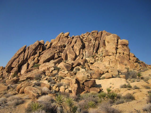
Joshua Tree NP- Day Four – 3/23/13 – Carey’s Castle and
Mastodon Peak – 11 Miles
Yesterday’s off-trail hike didn’t interest me, but today’s
off-the-map adventure sounded intriguing.
Jeff found a GPS track for this one on the internet, and we all know
that everything on the internet is accurate and trustworthy, right? But…who can resist searching for Carey’s
Castle?
As I mentioned previously, abandoned mines are spread all
around Joshua Tree NP and the origins of many are lost to time. This web page summarizes that in the late
1930’s Arthur Cary staked several mining claims in the area, including one
called the “Welcome Stranger” claim, and moved into a nearby shelter formed by several
huge boulders leaning against each other.
There is evidence (drawings on the rock ceiling) that this cave-like
space was once used by Native Americans.
Cary added rock and mortar walls, three windows and a door, and it
became his Castle. Once upon a time
there was a rough road that passed near the Castle (we saw a rusted old truck
bumper) but nowadays there is no road and no trail. Crossed fingers and Jeff’s GPS are the way to
go.
We drove through the Park and out the southern entrance,
took a couple of back roads, and parked in some obscure spot to start our hike
back inside the boundary line. Mental
bread crumbs for later: picture a piece
of paper with a horizontal line across the bottom – the road. At the top of the paper, treeless mountains
of rocks. Squiggly lines of sand rising vertically
from the road up to the mountains.
There’s your map.
Walking in deep sand again, following many footsteps up a
wide wash, seemingly flat but with a slight and steady elevation gain. Another day for interesting cacti and
flowers.
Jeff directed us left or right as the canyons split and we
began a pattern of climbing over boulders, walking up a small wash, climbing
over more boulders, another wash. We
were all going so slowly that I didn’t get out of breath, but a couple of times
I needed David to pull me up. Hiking
poles seem useless in boulders. After
2.5 hours and about 4 miles of what felt like an easy walk in between the
scrambling, we stumbled upon...
While Jeff sauntered off to bag yet another peak (3468),
David and I found the faint trail to Carey’s “Welcome Stranger” mine. Peering
through the grate we could see a ladder going straight down into pitch black.
Interesting that it is barricaded when so many mine openings in the Park are
not. This is supposed to be a
hard-to-find location, but I suspect plenty of people have checked out Carey’s
Castle and mine.
We retraced our steps with Jeff’s guidance back down out of
the narrow canyons to the wide valley floor. Jeff did his usual disappearing and
reappearing act from time to time, taking photos and enjoying some solitude,
and I kept a close eye on David. Jumping
off rocks makes me nervous and I wanted a helper if I broke a leg.
Remember that mental map I described earlier? The road is several miles going across the
bottom of the “page”, but whereabouts along that line did we leave the
car? We have to hit the road at some
point. Do we go straight, bear left or
bear right? Straight is relative. David seemed to be trending right, and my
memory leaned left, so I stuck with my intuition and trudged on. Just as I was beginning to tire, a glint of
light got my attention and I walked right up to the car. Jeff was a couple of minutes behind. We drove back along the road and picked up
David as he was approaching the road bed about a half mile away.
Time for one more? Of
course. On the way back to camp we had
to pass right by Cottonwood Spring Oasis, a vital water source for miners back
in the day. Records indicate that the
palm trees are native. Awesome, aren’t
they?
We hiked the easy three-mile loop that includes Mastodon
Peak. (We skipped the 3.6-mile trail
further out to Lost Palms Oasis.) The
summit of Mastodon Peak is a short but steep rock scramble that my body said
“no” to, so I waited at the bottom while the guys made the summit, a few
minutes of introspection. Just standing
and looking out across miles and miles of desert was very calming, a few deep
breaths in, burning a memory into the brain because we may never pass this way
again.
How is it that we have been in California this long and have
not had a Mexican meal? Tonight we found
one in 29 Palms.


No comments:
Post a Comment