Tuesday, March 31, 2009

Lonesome Pine

3/23/09 - Noland Divide Trail/Pole Road Creek Trail/Deep Creek Trail – 18 Miles

Lenny and I got an early start on our long day – 7:40 a.m. I was very excited about this hike because most of the miles were new to me and it completed the routes in the Deep Creek area. I tried not to think about the nearly 2,250-foot elevation gain coming in the first 3.5 miles. But there it was right at the beginning – the climb up Noland Divide Trail. The only sign of spring on this section of the trail was a single purple violet near the trailhead. After that, it was still winter, deep fallen leaves and no foliage peaking out.

But I grew to love this trail and it may well rank in the top five in the park. Still winter, so the southern views of Deep Creek Valley and even Bryson City were revealed at switchback after switchback. Acutely feeling my amateur status as a photographer, I kept snapping pictures in hopes that something would convey the scene.


As we climbed, the view opened up more and more. The fellow who put a red roof on his house (click on photo to full size and you’ll see it) wanted to make sure his house would be seen and he succeeded. When we reached the Lonesome Pine Overlook sign, Lenny continued on the trail but I could not resist taking the spur to the top. From there the vista is unobstructed, not quite 360 degrees – maybe 300? – and simply too big to photograph. I just stood and enjoyed. I’m telling you, if you want a great half-day hike, you can’t beat an out-and-back trip to Lonesome Pine. Take your lunch, but you’ll have trouble chewing with your jaw dropping open from the scope of the view.

Still many miles to go, so I caught up to Lenny and we continued on Noland Divide. The next section of the trail towards Pole Road Creek Trail leveled out and the walking was easy. There were chunks of quartz on the slopes, including this one beside the trail about the size of a refrig- erator. Along the AT ridgeline we could clearly see Clingmans Dome and Mount Collins, but we couldn’t see the tower. I finally stopped and pulled out my glasses and could see a white line that is the parking area, but no tower. I guess we were just a little too low. Anyway, yet another vantage point in the Park from which I’ve seen the highest peak in Tennessee. I had that déjà vu feeling from when Don and I hiked on Thomas Divide in January.

At the junction we headed down Pole Road Creek Trail. I don’t have any information on how this trail was named – any guesses about the “road” part? The “brown book” offers no help – its description is rather short and limited to the flora on the trail. The trail began as a comfortable downhill stroll, then I noticed a roaring sound and hoped it was Deep Creek way, way down in the valley – but no, there’s that little matter of the “creek” portion of the name. Pole Road Creek was waiting for us. In total we had four serious crossings, two that I was able to rock hop and two that I had to wade. I took the time to change to Crocs for them both, and also zipped my hiking pants legs off as the day had warmed up quite a bit. One of the rock hops was actually the biggest challenge. The creek had overflowed so wide that it flowed along the trail for quite a ways, making it difficult to pick the trail back up. But hey, I’m here, so we must have figured it out, right? And as we lost elevation, the wildflowers began to emerge. Wildflower experts - is this Fraser's sedge?

At last we reached the end of Pole Road Creek Trail and the long bridge over Deep Creek to connect us with the Deep Creek Trail. I had that home-free kind of feeling, but, boy, was I wrong! We had nearly 7 miles to go. At Campsite 56 we saw two trail volunteers repairing the bear cables. Let me stress the word volunteer – these guys hiked 7 miles in and 7 miles back out to repair bear cables.

Did you know that every backcountry campsite has a name as well as a number? (Look on the $1 map.) As I mentioned in my post from my January hike with Don, Campsite 57 is called Bryson Place and was the site of Horace Kephart’s last permanent camp. In January we looked for the millstone without success. Well, Lenny and I spent a significant amount of time looking for it today but still didn’t locate it. If anyone out there can give me clues, I’ll have to go back and look again. The campsite is quite large and there was lots of forsythia blooming – also a bit of trash around the campfire ring. (Horace would not be pleased.)

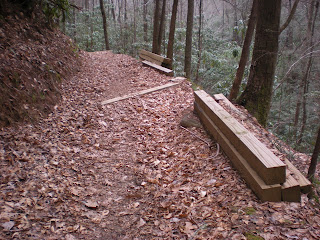
The next 4 miles of Deep Creek was a surprise up-and-down – again, I should have paid more attention to the elevation profile in the “brown book”. This section was very tiring and made for a long drawn-out end to the hike. There was lumber deposited at intervals, I assume for extensive trail maintenance going on. Lenny and I leapfrogged each other along this part as one stopped for a rest break, then the other. We saw campsites along the way, some occupied, even though this was a Monday. This is an easily accessible and therefore popular section of the Park – go elsewhere if you are looking for solitude, but this is a happening place if you like company.
Lenny and I parted at Deep Creek Horse Trail, which he needed to hike as part of his Smokies 900. I walked the rest of the way along Deep Creek, pausing to sit on a couple of benches – my feet were hurting once again. I passed a dozen folks out for an afternoon walk or run along the last couple of miles of Deep Creek Trail. Can you imagine being a resident here, having a National Park so accessible that it’s like your everyday town park? It didn’t feel crowded, just felt like a fun place to be. I walked (okay, limped) through the hiker parking and picnic area to our cars at the trailhead (the horse parking area) right at 5:00 p.m. and waited for Lenny. He emerged triumphant from the Deep Creek Horse Trail about 20 minutes later.

Once again I began the long drive home and a feeling of sadness lingered with me, disbelief that this adventure is nearly over. I have one more multi-day trip and then my grand finale hike on April 11. As with every major event in life, whether it be a party, a reunion, graduation, a wedding, or just a big vacation, there is a let-down after the fun is over and the dust is settling, and the big question, “What next?”

I watched an awesome sunset in my rearview mirror and thought about that.

After a day's walk everything has twice its usual value. ~George Macauley Trevelyan

Monday, March 30, 2009

Walking The Camel

3/22/09 - Low Gap II Trail/Low Gap I Trail/Big Creek Trail/Camel Gap Trail/AT/Low Gap II Again – 16. 1 Miles 

Today no one was waiting on me because I was hiking solo – and really looking forward to it. Remember last summer when the thought of hiking alone kept me awake at night? When I asked Marta how you get used to it, she simply said, “Repetition” and she was right. I feel comfortable with the safety precautions that I take and I’ve had some test experiences while with other hikers, so now the idea of hiking alone feels refreshing – especially on such a beautiful spring day.

Too bad the trail I was starting out on isn’t beautiful. By 9:00 a.m. I was staring Low Gap II Trail in the face again, this time looking up. My feet had not fully recovered from yesterday’s epic downhill, so I was determined to go slow and steady today. Not only was the hike plan (Hike #4 in the Big Creek/Cosby section of the "Day Hiker's Guide") to go UP Low Gap II, but the end of the day would see me going DOWN it – again. (Of all the hikes in the Park, I think I have been on Low Gap II the most times (4), along with the first couple of miles of the Lakeshore Trail.)

Low Gap II started out with a great show of wildflowers. Can someone name these white flowers? I’m guessing hepatica? And spring beauties were everywhere. Then a switchback took me away from the lovely forest and into the serious business – rocks, rocks and more rocks going steeply uphill. I concentrated on going very s-l-o-w-l-y.

After the first mile I met an AT section hiker going up, fully loaded and making slow progress. He was beginning a weeklong trek towards Fontana Dam, staying at Cosby tonight. The Cosby shelter is only about a mile from Low Gap on the AT and I wondered if he would get there and then decide to press on. When the weather is pretty it’s tempting to keep walking. As I continued up the trail I met four backpackers coming down, looked like high schoolers or spring breakers. They were moving fast, looking like they had cheeseburgers on their minds.

At the trail junction I crossed the AT and went straight onto Low Gap I Trail, which turned out to be more pleasant than expected, steep but winding open forest. I met two backpackers going up towards the AT. About two-thirds of the way down in a flat area I saw a long stone wall that bent inwards on both ends like a smile. Then the trail started going up and I saw a campsite far below on the left. I became confused because I didn’t remember the trail elevation going back up (need to pay more attention to that profile map) and I had a moment of hesitation but chose to keep going a few more minutes to see if I hit an intersection. Sure enough, the trail ended at Big Creek Trail as expected. But it seems to me that Campsite 37 is located differently than shown on the Park Map. Is it on the right or on the left?

Big Creek Trail ends and Camel Gap Trail begins just as a sign along the trail, not a true intersection. My walk on Camel Gap Trail was an absolute delight, following Big Creek on a gentle railroad grade most of the way. Doesn't this photo look like a crocodile head in the water? I was transfixed by the big water roaring over rocks, enjoying the solitude of this trail. The birds were more vocal than I’ve heard all winter and tiny lavender butterflies followed me. I was channeling Snow White walking through the forest (but the birds were definitely not imitating me when I sang.) I passed a couple of great camping spots (illegal, of course) and hopped across a few side creeks, saw lots of slimy stuff with eggs in it. At one spot a little creek tumbled in a small waterfall onto the trail, with these little plants sprouting. You flower experts out there – is it Brook lettuce?

At a switchback Camel Gap Trail begins its final climb to the AT, featuring big full views of the ridge of Balsam Gap Trail. I had that goosebump feeling again of looking at a ridge that I had recently walked on, in this case just two weeks before and covered in snow – seems so long ago. Time has a different feeling when you’re out in the woods. I paused for a snack at the junction where Carolyn and I had stopped on the last day of our snowy backpack trip. Here I noticed that along with the warm temperatures, wildflowers, butterflies and birds, the flying insects were also waking up and making their presence felt. Yellow jackets can’t be far behind, so pack the Benadryl and the epi pens again.

Back at the AT heading towards Low Gap II, I again walked this small section with awesome views and a great feel. It has narrow sections where the mountain drops off on either side of the trail and you can see Tennessee and North Carolina all around.

On a whim I checked in at Cosby Shelter, the only Smokies shelter that I had not actually laid eyes on, since Carolyn and I passed it by on our trek. The AT section hiker that I had met in the morning was there enjoying the peace and quiet, had the place to himself. We chatted for a few minutes and I learned he was from Spencer, NC, just up the road a bit from Charlotte. As I walked back on the AT I realized that we had never exchanged names.

At the junction with Low Gap II once again, I met three college break backpackers taking photos of each other and offered to do a group photo for them. They said they were heading to Cosby Shelter – so much for the section hiker’s tranquility! At least he had a few hours, and he seemed like the kind of guy who would enjoy company.

In spite of my care during the day, going slow, taking it easy on my feet and my lungs, the descent on Low Gap was painful as ever. When all is said and done, steep is still steep and 16 miles is still 16 miles. The wildflowers cheered me along, especially the yellow violets. I took the connector trail to the campground and walked through the campground to my car rather than going on the trail – probably the same distance but easier walking.

From Cosby I had a long drive to Bryson City where I was meeting Lenny for tomorrow’s hike in the Deep Creek area. In my hotel room I rummaged through my food bag for some supper and went to sleep early because tomorrow will be another long distance hike. What an awesome experience this has been!

Sunday, March 29, 2009

Mount Sterling Fire Tower

3/21/09 - Big Creek Trail/Swallow Fork Trail/Mount Sterling Ridge Trail/Mount Sterling Trail/Baxter Creek Trail – 17.2 Miles

The night before this hike I was a guest at an event in Asheville hosted by Danny Bernstein as a thank-you to people associated with the creation of her second book, Hiking North Carolina’s Blue Ridge Heritage (okay, I accompanied her to scout one hike from the book, but it still got me in!) It was a most enjoyable evening with some well-known members of the area hiking world. And to think I met Danny quite by chance when I signed up for a random CMC hike to test myself for this hiking adventure – or is anything really random?

Early Saturday morning I drove from Asheville to the Big Creek campground to meet my hiking buddy for the day, Jeff (aka Ken, aka Mr. Wonderful) for a long trek up to the Mount Sterling firetower. As soon as I got to the parking lot, Jeff called to say he would be “a little late.” He had a good story involving solo backpacking in Pisgah and finding his campsite in the dark. While I waited I watched the parking area fill up with hikers for this beautiful, warm, finally-spring day in the Smokies.

Once Jeff arrived, we took off walking up Big Creek Trail, passing a few hikers and being passed by a few horse riders. Big Creek is a level trail and we were so intent on conversation that we completed the 5 miles in about 1.5 hours, so making up a little time. At the Swallow Fork Trail we turned left and began our big climb. We had a couple of average stream crossings. I saw some hikers farther up the trail, so I sent Jeff up ahead so I could take a “trail break.” Just a moment too early (too late?) I saw the hikers coming around the corner and Jeff quickly stopped to chat with them. Moral: be careful where you pee on a spring Saturday in the Smokies! Ya ain’t all by yourself out there!

In total we saw 17 backpackers/hikers on this hike – most of them headed for Campsite 38 at the firetower. Fun!

Jeff and I ate a quick lunch at the junction of Swallow Fork/Mount Sterling Ridge/Balsam Mountain/Pretty Hollow Trails (hey Jeff’s mom – he loves your homemade strawberry jam). I remember being at this intersection back in July with Carol when the weeds were as tall as we were and all I could think about was how many snakes I was going to step on. We turned left onto Mount Sterling Ridge Trail and continued to climb a little bit, glimpsing the Maggie Valley area to our right. (The white streak in the photo – could that be a ski slope? Any guesses?) While on this trail we heard and then saw two helicopters buzzing around, flying towards the AT ridge.
  At the Mount Sterling firetower we climbed to the top to gawk at the clear blue sky and unlimited views. This tower felt much more stable than Shuckstack.


Magnificent


Majestic


No words


Couldn’t resist taking a picture of Jeff taking a picture of the surveyor’s marker at the tower base.

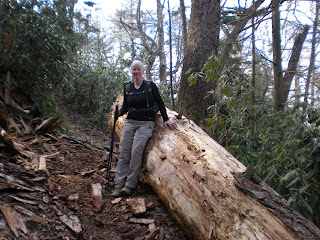
We did not have an abundance of time to hang around so we started down Baxter Creek Trail, six miles of downhill in a bit of a hurry, which hammered my toes and feet until tears came to my eyes. Jeff, who had hiked 20 miles with a backpack the previous day, was not dancing down that hill either. Our dogs were definitely barking on this section! Still, we paid enough attention to see this awesome fallen giant on the side of the trail.

And what about this knotty thing? The trunk has been severed just above the knot. Kind of looks like a fist grabbing it, huh?

On the lower half of Baxter Creek, wildflower foliage became very prominent and colors were emerging – loads of spring beauties, Dutchmans Breeches, huge trilliums as big as my out- stretched hand. By the time you all are reading this, the place will be a carpet of blooms. Get yourself out there! Look high up on the slopes and low down by your feet – it will be stunning. Be sure to tell me all about it!

Crossing Big Creek on the big bridge, we arrived back at the parking area right at 6:00 p.m. Heard later that one of my followers on this blog (hi Andrew) saw my car in the parking lot and wondered if it was me – I guess my bumper stickers give me away. So if you see my car around, leave me a note and say hi!

Felt good to sit down in the car and drive, felt bad to get out and walk to my hotel room in Gatlinburg. Can I really hike 16 miles tomorrow?

Saturday, March 28, 2009

Get Your Autographed Copy

Danny Bernstein, one of my hiking buddies, just published Hiking North Carolina’s Blue Ridge Heritage. (Milestone Press, 2009). In this guidebook, Danny covers 66 of the best hikes in the Blue Ridge National Heritage Area, an area which roughly encompasses the triangle from Pilot Mountain State Park to the Great Smoky Mountains National Park and down to Highlands on the Georgia border. In addition to being a hiking guide, Hiking North Carolina’s Blue Ridge Heritage discusses the history and heritage of the trails. From Stone Mountain's moonshine past to the Art Loeb Trail, nearly every hike has its own story to tell. And for you Smokies fans, there’s a large chapter on the North Carolina side of the national park. Danny will be signing books at Joseph-Beth in Charlotte on Saturday, April 4 from 11 A.M. to 2 P.M. The bookstore is located in SouthPark Mall, 4345 Barclay Downs Drive, Charlotte, 704-602-9800 If you’re close to Western North Carolina, join Danny at the official launch of her new book on Tuesday, April 7 at Diamond Brand Outdoors in Arden, NC, a little south of Asheville. Diamond Brand is located at 2623 Hendersonville Rd., Arden, 828-209-1501. She’ll be presenting a slide show program and Earth Fare will provide some great food. For every book sold that evening, Diamond Brand Outdoors will donate 50% of the proceeds to the Trails Forever program, which benefits the maintenance and improvement of trails in Great Smoky Mountains National Park. Additionally, Diamond Brand Outdoors will offer a $20 gift card for anyone that registers to become a member of Friends of the Smokies at the book launch event. And you’ll also be able to buy the new Dolly Parton CD, written and produced especially for the Smokies 75th anniversary.

Thursday, March 26, 2009

And It Was Raining

3/14/09 – Parson Branch Road/Hannah Mountain Trail/Rabbit Creek Trail – 14.3 Miles  

Last summer and fall I focused on hiking trails that originated/terminated on park roads that are closed in the winter months. One gamble I took was the Hannah Mountain trailhead off of Parson Branch Road. The hike route is Hannah Mountain and Rabbit Creek Trail to Abrams Campground, a big shuttle hike, and I put it off until the spring. Well, I lost my bet with myself because Parson Branch did not reopen on schedule due to erosion problems from flooding. Once again we were faced with a Plan B – hiking four miles up Parson Branch Road to the trailhead. And it was raining.

The last time that Danny and Lenny and I tried hiking from Abrams Campground we had difficulty finding the place – Danny tracked it down while Lenny and I were on the trail. So on this day Danny led us to the campground entrance, where we left Judy’s car. Then Danny headed off to revisit some popular trails on the way to Sugarlands VC and the three of us drove along the Dragon’s Tail (Highway 129) in search of the exit end of Parson Branch Road. We were a little nervous about finding the right road, not knowing whether it would be marked, not having a lot of time for trial and error, having only a vague idea of mileages. We did find it, although there is no sign naming the road, just a “Do Not Enter” sign and a gate across. For those of you looking, it is at a green-&-white mile marker 4 on Highway 129. So off we went up Parson Branch Road. And it was lightly raining.

Within the first third of a mile we came to a place where Parson Branch flows across the gravel road. A concrete pad has been poured for the width of the creek flow, so no rock hopping here, and the water was several inches deep. Judy’s feet were immediately soaked, Lenny plowed through as usual, and I danced through on my heels clogger style and managed to stay relatively dry. We got to practice our methods 16 more times, some places deeper, some places shallower. And it was raining.

The road walk was okay, a bit steep in places, but a well-graded gravel road. I counted three places where repairs really were needed before I’d take a car on it. There was heavy equipment at the parking area for the Hannah Mountain and Gregory Bald trailheads. Hopefully repairs will be completed and the road will be opened soon. Still raining.
  Hannah Mountain trail is truly a pleasure to walk on, few rocks or roots and plenty of pine needles. It’s a ridge walk with little noticeable elevation gain or loss. About 2 miles into the trail Judy found a tree to hug, a great-great-great-grandfather poplar tree with “warts.” We passed one hiker who told Lenny he was delivering supplies to a campsite for a friend. My guess was the supplies were beer or something consumable, or else the friend would have to carry it out again, right? We stopped time and again to adjust clothing, first warm, then chilled, always a little damp. Judy is adjusting something underneath her Packa, a combination poncho/raincoat/pack cover made of silnylon. And it was raining.

The rain was variable all day, light to moderate, and we had several quick snack stops. I watched the clouds drift between the mountains up close and far away, the peaks playing peek-a-boo in the mist. I took lots of photos, none of which really captured the mood. Even though we all prefer sunshine, the colors of the day, black, gray, white, silver, were lovely in their own way. Days like this are necessary for our mountains to be beautiful and alive. And all those pine trees? In one spot there was a fungus growing along the edges of the bark that gave the distinct appearance of snakeskin. And still it was raining.

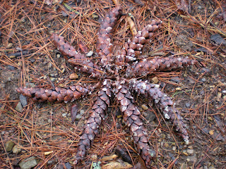
Because of the brevity of our stops (who wants to sit in the rain?) we reached the junction with Rabbit Creek Trail quickly, turned left and began our one real climb of the day over Pine Mountain. The only thing of interest I saw along this portion of the hike was the abundance of pine cones, long, slender and slightly curved, looked like they were tipped with silver. I kept looking and looking, and finally could not resist arranging a group of them into a swirling star pattern. (Yes, I scattered them again after I took the photo.) And, yeah, it was lightly raining.

At the bottom of Pine Mountain we walked along Abrams Creek, passing obvious homesites in this bottom land. The trail was edged with thick daffodil foliage, that sure sign of past human habitation. And the daffs were nodding heavy with moisture because it was…raining.

At last we arrived at what I had been dreading all day – Abrams Creek. We knew from the Park’s trail cautions page (where the Hazel Creek bridge issue is now also posted) that the footlog across Abrams Creek was gone. (That note is no longer on the website so I don't know the current status.) Lenny had been here before and his recollection was that the crossing was perhaps knee deep but with a smooth bottom. Well, like raising teenagers, you can’t get around it, you gotta go through it…Lenny and I have developed a great system where he goes first and I learn from his mistakes and don’t follow him, but today it wasn’t too hard of a choice. The bottom was relatively smooth and we all waded across just fine. (But Judy and I will never face a creek crossing lightly again.) And it was gently raining.

Now we faced a shuttle to retrieve my car from Parson Branch Road on Highway 129 and a very long drive back to Gatlinburg (Judy clocked the trip at about 100 miles). We stopped briefly at Tribal Grounds coffee shop in Cherokee to revive ourselves. With java in hand and cruising through town, we saw what looked like an accident ahead, cars stopped on the road in both directions. Getting closer, we realized it was an elk standing on a wooded hillside (for those of you intimately familiar with Cherokee, it was between the Totem Pole gift shop and Boundary Tree Road). The elk was a young male just beginning to grow his antlers, and he was chewing and gazing and posing for photos. Dontcha just love wildlife? We met Danny at Smoky Pines, my favorite hotel in Gatlinburg, and after a quick change of clothes we went for dinner at Ogle’s Pizza & Pasta – delish! Then we hung up things to dry and caught some ZZZZ’s before our next day’s hike. Still raining.  

Postscript: We got up early the next morning and had breakfast at Shoney’s, watching the rain coming down even harder than yesterday. Judy and I made the snap decision that we did not want to walk another day in the rain. She headed for home, and I shuttled Danny and Lenny to set them up for their hike on Grapeyard Ridge and Baskins Creek, and then I turned towards Charlotte too. Got home in time to see my two younger kids on their last day of spring break before they went back to their respective schools. Rained all the way home.

Tuesday, March 24, 2009

A Little Something For Everyone

3/13/09 - Bote Mountain Trail/Lumber Ridge Trail/Meigs Creek Trail Plus Crib Gap Trail – 14 Miles 

I spent the night at Danny and Lenny’s home and we left early for the long drive to the Tennessee side of the Smokies. The forecast was for rain today and tomorrow, a hope of not-rain on Sunday. We met Judy at the Sugarlands VC, dropped two cars at the Sinks, and drove to the Bote Mountain trailhead. Danny has finished all of the Smokies 900 now and I needed the Lumber Ridge section of today’s route. Judy needed to cover everything but Meigs Creek (she and I did that trail together in January) and Lenny needed nearly everything, I think. Anyway, an easy to moderate hike plan for today. And although it was overcast, it never really rained.

 We headed up Bote Mountain, chattering along, and quickly reached the West Prong intersection. Danny and I sat down while Lenny and Judy went .3 miles further to tag up with Finley Cane Trail. Then we all headed down West Prong, a densely wooded trail that winds down to Campsite 18, where we paused for “elevensies.” Resuming our walking, we startled two white-tailed deer (and vice versa). Was this near the place where I thought I saw two bears back in October when I hiked this trail with Mike?

As we neared the end of West Prong Trail we saw a couple of well-worn side trails, and I thought I saw people at a campsite, although there is not one shown on the Park map. This was one of those days when I had not read the trail descriptions in “Hiking Trails of the Smokies.” We quickly clued in that we were looking at flowers and therefore a cemetery. We followed one of the side trails and indeed it is a large cemetery enclosed by a fence and a gate, obviously well maintained and often visited. In addition to the photos here, there were many infant graves and a couple side by side with headstones marked “Mama” and “Papa”. This cemetery is just a short walk from the trailhead on Tremont Road, so even if you’re not a hiker, take the time to go check it out, and be sure to read the fascinating narrative about Vannie Cook in the “brown book” . Whenever I pause at a cemetery in the Smokies I feel as though I am visiting my parents’ gravesites.

We stopped briefly at the Tremont Institute gift shop. While Danny chatted with the employees, the shop was suddenly overrun by middle school children and Judy and I escaped outside. There we met one of the adults attached to the school group that was there for a field trip for several days. Hey, my school never took us to the Smokies! All we got was Myrtle Beach for the senior class trip (and there is a pact not to confess anything…)

Funny, I don’t remember much of anything about the long, slow climb up Lumber Ridge Trail. Maybe I was just looking forward to the challenges of Meigs Creek Trail again…and it did not disappoint. The 18 creek crossings were still there, about the same as when we hopped them in January. As you can see, Danny and Lenny are not the rock hopping type, preferring to avoid wobbly and slippery rocks and just get wet. This was the first time we were facing moving water since our Hazel Creek adventure and Judy was a little apprehensive, but she sucked it up and hopped them all.

At the end of Meigs Creeks Trail, of course, is the Sinks. Danny and Lenny went on to our motel in Townsend, while Judy and I drove towards Cades Cove so I could pick up a loose thread trail called Crib Gap. We parked one car at the Turkeypen Ridge parking area and then started from the Cades Cove picnic area on Anthony Creek Trail, picking up Crib Gap Trail after only a short distance. For all you critics who think we just churn out the miles, it is near here that we stopped to smell the flowers.

I must report that Crib Gap Trail is a boring horse trail (well, we did see one old chimney a few hundred feet away but did not investigate). It crosses Laurel Creek Road and continues to be a boring horse trail, always within earshot of traffic. The only interesting fact noted was that the decaying leaves seemed to glow like a silvery carpet, perhaps because of the late afternoon light. When we reached the intersection with Turkeypen, we opted to follow the unnamed horse option that passes through a tunnel under Laurel Creek Road, then turns right on Finley Cane Trail and goes back to the parking area by the road.

So much for Crib Gap Trail! Now…what’s for dinner?

Wednesday, March 18, 2009

If Barney Fife Were A Backpacker

AT Backpack Weekend – Day Three – 3/8/09 – Appalachian Trail/Snake Den Ridge Out-and-Back/AT/Low Gap II Trail – 12.7 Miles 

  Turning the clocks forward an hour made getting up a little harder. The ridge runners were moving around first and our group began moving about 7:30 a.m. We had plans to get to the car at Cosby Campground by various routes. Jeff was again leaving early to do some side trips on the AT and then going down Snake Den Ridge Trail to the camp- ground. Judy and Carol were also taking the AT and Snake Den Ridge. Carolyn and I were taking the AT further to Low Gap II Trail and down to the campground, and since our route was the longest we left before Judy and Carol. First we had our photo op (from left): me, Jim, Judy, Susan, Carol, Carolyn.

Every trail from a shelter seems to go up, and we began climbing up Mt. Guyot. According to “Hiking Trails of the Smokies,” Mt. Guyot is “the fourth highest peak in the eastern U.S. and the second highest peak in the Smokies. It holds the distinction, however, of being the highest mountain in the East that has no trail or road to its summit…few people enjoy the splendid isolation afforded atop Mt. Guyot.” Well, we stayed on the trail, but Jeff bushwhacked to the summit to have himself some of that splendid isolation.

Nearly three miles from Tricorner Knob, the AT passes through a big clearing at Deer Creek Gap, not a true bald but a field that resulted from a wildfire in 1924 that burned up to the summits of Mt. Guyot and Old Black. The area is grassy and edged with berry bushes, and in the middle of the trail there are two large V shapes made of asphalt. This is a helipad used for emergency medical evacuations along this area of the AT. Ridge runner Jim told us a story last night about rescuing a diabetic backpacker last year who could not walk. A horse carried him from Tricorner Knob to the helipad site and he was airlifted out. I’m not sure, but I’m assuming the ridge runner was there and met the guy in trouble and was able to radio out for assistance. Anyhoo, an interesting spot on the trail. Oh, yeah, and the view from Deer Creek Gap? Not too bad.

At the junction with Snake Den Ridge, Carolyn and I dropped our packs and jogged .7 miles down the mountain to the intersection with Maddron Bald Trail. (It’s steep and without the packs our feet barely touched the ground.) We were here at this intersection on a very rainy day back in July 2008. About halfway back up to the AT, Judy and Carol passed us on the last stretch of their hike, and so we knew we would be an hour or so behind them in arriving at the campground.

The next 4.7 miles on the AT consisted of view after awesome view. If you ever get the opportunity, you’ve got to hike the AT through the Smokies, folks. It is truly inspirational.

I love this photo of me passing a white blaze on the AT in the Smokies – I think I’ll have it framed!

The day warmed up to short sleeves temperatures. Carolyn and I paused at intersections, but we still made great time, and the last AT section was steep going down to the Low Gap Trails. At that junction we met a group of young spring break guys who were day hiking up to the Mt. Cammerer tower. It was amusing to tell them we were backpackers – I felt like a female Barney Fife with my thumbs in my pockets saying, “Yeah, just out for a little weekend trip, you know, something us big strong backpacker women do all the time.”
   Low Gap II Trail is a relentless downhill and I could not keep up with Carolyn, whose long legs were pulled along by gravity at lightning speed. Eventually the trail eases up and joins Cosby Creek with some wonderful cascades. And we saw the first wildflowers of the season – spring beauties!

At the first intersection we turned left because I thought it was another approach trail that I had yet to cover. At the end of the .4-mile trail there was a sign designating it as the Cosby Horse Trail – so I didn’t have to do it after all! But it put us near the campground and on our way to the hiker parking area. At the car, we were happily surprised to see that we were the last to arrive at 2:30 p.m. The parking lot was buzzing with hikers, some just there for the day and some obviously coming out from weekend trips. The sky was blue, the temperatures were warm and spring was almost here.

BUT…we had to drive through Gatlinburg. We made a brief bathroom stop at Sugarlands VC and as we were walking back to our car, a couple passed us carrying a box of Krispy Kremes and some cupcakes heading for the (shriek, gasp, horrors!) trash can. I couldn't stop myself - I blurted out something sophisticated like, "We've been backpacking all weekend and can we have your doughnuts?" My first Yogi score! The doughnuts were delicioso. We returned Jeff and Judy to their cars at Newfound gap and then Carolyn and Carol and I made our way through Cherokee and the long way back to Charlotte. We rolled into my driveway at 8:00 p.m. I left all the dirty clothes and gear in the car and headed for my comfy bed.  

“I’ll think about that tomorrow…after all, tomorrow is another day.” ~ Scarlett O'Hara