Wednesday, June 12, 2024

South Dakota: Centennial Trail Day 2 - French Creek Horse Camp to Mount Rushmore Overlook

South Dakota: Centennial Trail Day 2
French Creek Horse Camp to Mount Rushmore Overlook
6/6/23 – 17.1 Miles

Rise and shine!

Woke up with early sun, sore muscles and soft spots where my new backpack rubs (not surprising, I think I’ll get used to it). As Nancy sipped her coffee, I made an effort to eat breakfast to keep my calorie intake up. Carrying 5 days’ worth of food, every little bit in my stomach means a lighter load on my back!

An ambition day ahead, still trying to shake the aftershock of our delayed start. We had only an idea of where to camp tonight. Our rough plan was to hike past Legion Lake (our intended campsite) and Iron Creek Horse Camp and look for a soft place to land near the side trail to Mount Rushmore. (Yes, we are going to Mount Rushmore!) Paying attention to water sources will be important. Ideally we’ll find a suitable spot not far past Grizzly Bear Creek and be set up to conquer Mount Rushmore first thing in the morning on Day 3.

The guidebook I’m using, Hiking Centennial Trail, 2nd Edition, includes detail of alternates routes during high water like French Creek, which was flowing merrily past our campsite. Since it was running clear water and within its banks, we didn’t really consider the alternative route. Will we get our feet wet? Oh, yeah.

You’ve been warned, don’t make us come and get you!
In reality, French Creek Natural Area is 12 miles wide east to west, and we crossed it in just
 a little over one mile south to north, along its western boundary.

French Creek flowing along the base of a rock outcrop

First refreshing crossing of the day

Morning sun lighting up the hills - second crossing

Another reptile traveler (Nancy’s trail name is now “Snake Charmer”)

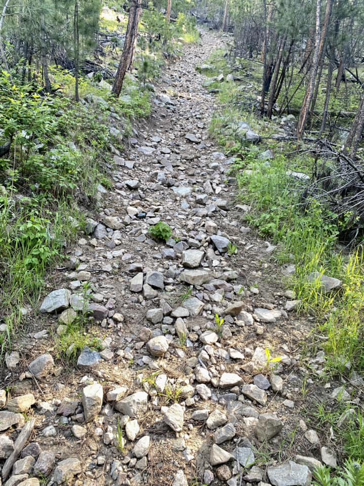
The trail began to climb, winding through pine forest, and Nancy went ahead as I plodded slow and steady. At a faint intersection, I stopped to check my GAIA and Nancy reappeared, backtracking to ascertain our direction. Once we agreed on the way forward, we found ourselves on a very disagreeable steep, rocky grade.

Referred to by some as Hell’s Hill, but others say this is an improved reroute (what??)

At the top of this “hill” we stopped, me to gasp for breath, Nancy to admire the view. A man and woman were also stopping there and we got acquainted. Husband “Sticks” and wife “Bug Bite” hailed from Tennessee and were also thru-hiking the CT. [Sticks is a 2010 AT thru-hiker.] Our conversations continued as we hiked on towards Legion Lake, and eventually Nancy and I pulled ahead.

So far today, navigation had been straightforward, trail signs appearing where we needed them, but as we got closer to Legion Lake things got complicated. The main trail circumvents the lake altogether, going around its western edge, but we wanted to have lunch at the Lodge on the eastern shore (one of Bridget’s stops on our “tour”…just yesterday?)

Many trails intersect in this area, and as we crossed Heddy Draw Horse Trail we realized that our paper maps and GAIA showed different routes. In fact, the CT had several variations going around both sides of Legion Lake! We parsed out the shortest distance to the Lodge, and before you could say “I’d like a milkshake with that,” we settled at a table with salads as Sticks and Bug Bite arrived to join us. 

Nancy approaching Legion Lake Lodge

Kayakers on Legion Lake

Super salads

Me, Nancy, Sticks and Bug Bite

So far, we were 6.3 miles into what would end up as a 17.1-mile day. We said goodbye to our thru-hiker friends and walked through the Legion Lake campground to connect with the main Centennial Trail.

Getting closer to the northern boundary of Custer State Park, the trail switches between single-track trail and two-lane logging roads, more sun exposure than yesterday. This ain’t the “green tunnel” hiking we have back in NC.

Granite pinnacles

Trying out my hiking umbrella, a game-changer in that strong sun!

At Iron Creek Horse Camp, the CT leaves Custer State Park and enters Black Elk Wilderness. It is the only designated wilderness area in Black Hills National Forest and is named for Oglala Lakota holy man Black Elk, as is nearby Black Elk Peak, the high point of South Dakota. These lands are sacred to the Lakota people. [Later in my SD adventures I have the opportunity to hike to the summit of Black Elk Peak.]

The change in land management practices is evident as the terrain changes, large rocks part of trail-building, narrow muddy horse trails, and occasional trail markers cut into tree trunks. Use of any motorized or mechanized equipment is prohibited in wilderness areas – no chainsaws to remove large trees – and I was impressed that we didn’t run into any significant obstacles during our hike through this stretch. [That means the trail maintenance crews are keeping up with blowdowns.] I found myself enjoying this part of the hike, thinking of Linville Gorge Wilderness back home. 

Around three miles past Iron Creek Horse Camp I hopped a small creek and mounted a switchback to find Nancy waiting for me with a tentative grin on her face. “What do you think about this as a campsite?” I looked around and, indeed, there were a couple of flat spots. I hadn’t expected to stop here, but Nancy has good instincts. Then she pointed through the trees to a granite mountain range…Faces? Presidential faces?

We were on a little rise so there was no water source, but if we stayed here, Nancy offered, she could backtrack to the small creek and collect water for the two of us. A bargaining chip – did she think I would say, “Nah, I don’t feel like camping with some guys looking at us”?? Well...okay.

We set up tents, carried our food and stoves to a rock outcrop view of the big guys, and ate dinner by twilight. [Nancy’s photos below.]

Our campsite

Fine dining

Light show glow on Mt Rushmore

Next morning's view of Mt Rushmore from our campsite

Much gratitude to Nancy for choosing this site! A reminder that you can plan for months, but being open to what nature shows you makes the most special memories.

“Peace will come to the hearts of men when they realize their oneness with the universe.
 It is everywhere.”
 ~Black Elk


Wednesday, June 5, 2024

South Dakota: Centennial Trail - The Plan & Arrival Day

South Dakota: Centennial Trail - The Plan & Arrival Day – 6/4/23

Raise your hand if you’ve got a bookmarked list of long hiking trails, the stuff of yearning, sauntering off into the wild with a clear weather forecast, a loaded backpack and a light heart. Many of those adventures are in the “daydreaming-only” category, some are in the “maybe-someday” category, and probably two or three are in the “I-must-do-this” category. The rankings are very scientific: how does hearing the name of that trail make me feel?

The Centennial Trail in South Dakota caught my attention in 2022, in an area of the U.S. that I’ve never visited. It stretches 124 miles between Wind Cave National Park in the south and Bear Butte State Park in the north, traversing Black Hills National Forest, the Black Elk Wilderness, and Custer State Park. Fun fact: the trail passes within one mile of Mount Rushmore National Memorial.

The varied terrain of prairie grasslands and Black Hills High Country intrigued me, and roaming buffalo and prairie dogs sounded pretty cool. As I read more about the history of indigenous peoples in the Black Hills, I felt the pull of the land beyond the CT. I began planning a thru-hike with extra days to explore the southwest corner of South Dakota.

I highly recommend the book Hiking Centennial Trail, 2nd Edition, and the Hiking SD Centennial Trail Facebook page as invaluable resources. *NOTE: There is also a Centennial Trail in Idaho/Washington State – if you want to go, make sure it’s the right one!

A 9-day solo backpacking trip was a stretch for me and I was determined to channel Eleanor Roosevelt to “do one thing every day that scares you.” BUT when my good friend Nancy East expressed interest in joining me, I thanked the universe for giving me an experienced, good-natured, certified search-and-rescue partner for the journey. My hubby Jim was glad too!

The night before our departure, Nancy and I spent a couple of hours making final decisions on gear – what can we do without? We’d each shipped a food resupply box ahead to the midpoint, but otherwise this was a hike with few options for second thoughts.

I carried more than the usual trail jitters with me to the airport. We checked our bags of hiking gear and listened to announcements as our direct flight to Rapid City was delayed (more time to stir up those jitters.)

Finally – here we go!

Well, we arrived in Rapid City but my backpack didn’t come through baggage claim – what? Texts came from the airline that my bag would be on a “future flight.” In fact, it was winging its way to Dallas, TX because who the heck knows why?

I became flustered, and Nancy was very helpful in calmly tracking the bag (new meaning for “search-and-rescue”). Its estimated arrival time to Rapid City: 9:00 pm.

We will not be starting our hike today.

Our shuttle driver, Jon, picked us up at the airport and quickly switched gears to help us out. He and his wife Bridget, owners of Roam'n Around Travel & Outdoor Gear, are the nicest trail angels of the hiking world I have ever met! They shuttle and support hikers all up and down the Centennial Trail. They invited us to stay at their house instead of a hotel (yes!) and took care of us in more amazing ways as we waited for my backpack to show up.

Nancy and I spent an unexpected but delightful day walking around Rapid City, checking out the splash park at Main Street Square and Prairie Edge, a combination art gallery and Native trading post. We found Silver Lining Creamery and Firehouse Brewing Company (did you doubt it?)

A pre-hike toast

Roam’n Around was closed on Sunday but we’ll be back!

Main Street Square in Rapid City

We hung out at Jon and Bridget’s house, learning about their love for their city and the trail, stories of hikers in seasons past, and what we were about to jump into. At 9:00 pm Jon drove me back to the airport and my pack arrived intact from Dallas – relief! Or is it?

We will begin our thru-hike of the Centennial Trail at the southern terminus in Wind Cave National Park tomorrow morning, but we’ve lost our 6-mile “head start” today. Tear up the game plan and begin again!

Looking back, losing my pack was an enormous blessing.  All my planning was derailed, upended, and altered to something better than I could have ever envisioned. 

“… and that has made all the difference.”
 ~Robert Frost


Tuesday, April 23, 2024

Waterfall 100 Challenge: Steels Creek Falls & Bard Falls

Waterfall 100 Challenge: Steels Creek Falls & Bard Falls
 Pisgah National Forest, Grandfather District – 5.5 miles - 6/2/23

Bard Falls

SOOOO CLOSE…to completing the Carolina Mountain Club Waterfall 100 Challenge! Just two in the Linville Gorge area and two in Pisgah National Forest’s Ranger District and then I will…probably start another hiking challenge. [The CMC Waterfall Challenge list is here, newly revised in February 2024.]

What’s up with these challenge lists? I’m a fan because I learn about places I would likely not find out about on my own. The completion thing motivates me, but true satisfaction comes with every single hike to a beautiful place in nature.

Waterfall hiking in the Linville Gorge Wilderness on a summer day. Jim and I set our sights on Steels Creek Falls first, then we’ll pick up my long-time hiking friend Cathy and head to Bard Falls.

For those of you who like maps, on Highway 181 north of Morganton, NC there’s a forest road (well, there are many forest roads) leading deep into the Grandfather Ranger District of Pisgah National Forest. FR 228 is the road to God’s Country, they say. Long, winding and narrow, 4 miles at 5mph took longer than we expected. No cell service so unable to let Cathy know that our time estimate was way off…

Sometimes Jim photobombs his own self

At the end of the road, a trail leads up the creek for a quarter mile to this sweet swimming hole

Looked innocent enough until we saw the crossing above this spot, deep water in between big rocks. Seeing the bottom wasn’t easy, and no chance of rock hopping, so we chose carefully before moving our feet. Of course, we had to return the same way.

On the far side, the side trail soon connects to my old friend the Mountains-To-Sea Trail (MST), where we turned right to follow Steels Creek upstream. [When I hiked this section of the MST in 2011, we passed right by Steels Creek Falls but didn’t take the side trail to see it.]

The rugged trail goes steeply up, then down, then up, then level, then…well, you get the picture. A lot happens in about .6 miles, always within sound and/or sight of the creek, sometimes with one foot IN the creek.

Looking downstream

Red Trillium (aka wakerobin) ready to burst

In wilderness areas, you have to look closely for an unmarked side trail to a waterfall, and it’s often a slippery scramble. This one was typical, with handy ropes set to ease the way (if you trust ropes set by someone else, that is). 

Jim and I agreed not to risk life and limb to walk out on a rock ledge to get up close to the falls. This viewpoint was just fine to see the huge potholes made by the powerful cascading water. 

Steels Creek Falls

My favorite hike blogger’s report of Steels Falls with great photos is here.

Fast forward: drive back up FR 228 at 5mph, pick up Cathy, switch to FR 464 aka Pineola Road (still in Grandfather District of Pisgah NF) to the Harper Creek Falls area. Bard Falls is also on the Mountains-To-Sea Trail and I also passed it by in 2011.

Cathy and I are ready to go!

The shortest route to Bard Falls begins at North Harper Shortcut Trail (266A), a 1.1-mile descent through a fern forest on a well-graded trail that doubles as the MST. 

Turning left at the junction with North Harper Creek Trail (266, still designated as the MST), it’s about .7 miles downstream to Bard Falls. Know before you go: one wide wet crossing of North Harper Creek cannot be avoided. A couple of years ago, Cathy and I attempted to reach Bard Falls with her dog Ellie, but the water was too high and we turned back. Today the creek was calm and ankle deep.

North Harper Creek – Cathy walking on water

Continuing downstream, we followed the creek as it grew bigger and louder, tumbling through boulders. We glimpsed the top of Bard Falls and found the rugged trail down to the base – no ropes this time, but slippery rock ledges similar to those at Steels Falls. A couple of broad pools below the falls are inviting to wade, but we were not tempted to walk upstream into the flow of the waterfall. 

Bard Falls – check out the heart-shaped pothole on the left

Pool below Bard Falls

My favorite hike blogger’s report of Bard Falls with great photos is here.

The Harper Creek area is fairly easy to get around with intersecting trails to create loop routes, and lots of creek crossings and waterfalls to enjoy. Remember, safety in numbers when hiking around water features. Be ready to get your feet wet (and more)!

And don’t forget to wet your whistle in Morganton at Sidetracked Brewery!

"A river cuts through rock, not because of its power but because of its persistence."
 ~Jim Watkins

Friday, April 19, 2024

Palmetto Trail: Enoree Passage Section 3

Palmetto Trail: Enoree Passage, Section 3, MP 27 to MP 37 – 10.2 miles – 5/13/23

My Centennial Trail thru-hike in South Dakota is coming up fast and I’ve been training with my new Gossamer Gear backpack. Time to load it up for a 10-miler. My friend Mike invited me to scout hike a section of the Palmetto Trail in South Carolina, new miles for me. His friend Lynda, who’s training for her third Camino in Spain, joined us for a beautiful walk in the spring green of South Carolina.

We dropped my car at the entrance gate to Sedalia Campground (closed for some reason?) and followed Mike on a twisty-turny route to remote Forest Road 334, MP 27 of today’s trail section. [Most hikes with Mike begin this way and that’s why I appreciate his skills and willingness to do complicated things.]

Lynda heading into the woods

Mike’s focus along the route was documenting blowdowns and other issues requiring trail maintainer crews, marking GPS coordinates, photos and description of the conditions. [He noted more than a dozen blowdowns that needed major work.]

Slow going, while Lynda and I pushed ahead and then waited in the shade for him to catch up. The air was hot and muggy, South Carolina’s specialty. Nature kept us on our toes today, showing her miracles beneath our feet.

In our first mile we crossed Sispring Branch on a medium size bridge 

A campsite fire ring not far from the road 

Mike pointed out a concrete foundation wall on a small rise, no clues as to its long-ago function. As we turned back to the trail, Lynda nearly stepped on a very large black snake.

My guess is he was longer than 5 feet, with a small head, a chubby body and narrow end. We noted his white underbelly. [My research *Google* says maybe a black rat snake or a black racer.]

Crossing the Enoree River on an impressive high bridge

Enoree River, muddy water from recent rains

The boardwalk on the north side needs some love. Some boards felt “squishy” and some were missing altogether. More notes and photos for the maintainer folks.

From that point, the trail mostly follows Johns Creek, not visible from the trail because of foliage. Saw another black snake before it could surprise us. Is it bigger than the first one?

Turkey tail fungus thrives on dead logs

We crossed the grassy dam on the eastern edge of Macedonia Lake (the first of three lakes on today’s hike) looking for a place to eat lunch. While the view was sweet, the bugs and direct sunshine were not. 

Mike asked what, in addition to shade, were requirements for a nice lunch spot. We decided on ferns and logs to lean or sit on.  Soon a shady bit of open forest covered in pine needles, leaves and ferns appeared, and we spread out so everyone had a personal log. The humidity was still intense, but the break for rest and conversation revitalized us to push on.

Sundrops

Heal-all

Common cinquefoil

At the second lake (Sedalia Lake) we encountered a couple of fishermen. An elderly Black man asked us where we were walking and we explained that the Palmetto Trail goes across the state. He didn’t know about that, he said, but “we used to play in these woods as kids because that’s all there was to do!”

At the third lake (Johns Creek Lake) we saw our new friend again – he had relocated to try a
new fishing spot. Rain clouds began to roll in as we entered the last stretch of our hike.

We reached Old Buncombe Road and cut across a church parking lot and cemetery to Bombing Range Road (where did that name come from?) Just a half-mile further, we reached my car and blessed air conditioning. We retrieved the second car as fat raindrops began to splatter around us.

The shakedown: my Gossamer Gear pack weighed about 20 pounds today, and final pack weight for the Centennial Trail will hopefully be no more than 25-27 pounds. I practiced adjusting straps and belts and I think the pack is going to work well. I also wore my newest pair of Altra Timp 5 trail shoes.

Time to refuel and hydrate. We found the Hillside Restaurant & Bar in Chester, SC – delicious food and Black Widow cider! Another happy ending to another walk in the woods with friends.

“It’s not the heat, it’s the humidity.”
 ~Every Southerner That Ever Lived

“If it gets any hotter, I’ll have to take off stuff
I really ought to keep on.”
 ~See Above