Thursday, September 14, 2023

Colorado 2022: Mesa Verde NP - Cliff Palace & Petroglyph Point Trail

Colorado 2022: Mesa Verde National Park – Cliff Palace & Petroglyph Point Trail
8/10/22 – 3 miles

As Jim and I planned our Colorado trip in 2022, Mesa Verde NP was undergoing extensive preservation work on some of its signature features, and we timed our August visit with the resumption of ranger-led tours for sites such as Balcony House and Cliff Palace. (Some sites were still closed.) Looking at the matrix of tour times and driving distances, we chose quality over quantity and booked only a tour of the Park’s centerpiece: Cliff Palace. Even so, I didn’t time the bookings quite right and ended up with one ticket at 10am and one at 10:30am (shrug).

[If you’re going: Cliff Palace can be viewed from an overlook without purchasing a ticket.]

It’s a long drive from Cortez to the Park entrance and then to the tour meeting place on Chapin Mesa, but my time-obsessed-self ensured that we were quite early. My time-obsessed-self’s twin sister rule-follower-self watched judgmentally as a family showed up and tried to tag onto the 10am tour. (They were successful because of no-shows.) Jim could have asked, too, and joined with me. Perhaps…he was happy to be in a separate group of his own?

Lesson learned: ask if you can tag in.

From this NPS website: “Sometime during the late 1190s, after primarily living on the mesa tops for 600 years, many Ancestral Pueblo people began moving into pueblos they built into natural cliff alcoves. The structures ranged in size from one-room granaries to villages of more than 150 rooms. While still farming the mesa tops, they lived in cliff dwellings, repairing, remodeling, and constructing new rooms for nearly a century.”

Cliff Palace is a cliff dwelling that has existed for over 700 years, but its “discovery” in 1888 accelerated the deterioration of this extraordinary site. Read more here about ongoing preservation work at Mesa Verde NP.

First look at Cliff Palace

The tour begins by descending a ladder on the left side and moves through the site. It ends by climbing three ladders at the far right, so groups don’t pass each other. Archeological studies conclude that the site contained 150 rooms and supported a population of about 100 people.

Our guide, Ranger Lou Ann, was passionate, knowledgeable, and respectful of the indigenous peoples that lived in cliff dwellings. Her descriptions brought them to life living in community, cooking fires, everyday chores, caring for their children. She explained that although Cliff Palace was built with the intention to live there indefinitely, after about 90 years their population had increased to a point that there was not enough space or reliable water to sustain the community.

The website continues: “In the mid-1200s, the population began migrating to the south, into present-day New Mexico and Arizona. By the end of the 1200s, most everyone had migrated away.”

Kivas are primarily round, underground rooms used for both routine purposes and special ceremonies. There are 23 kivas at Cliff Palace (not all visible on the tour). Read more about kivas here.

The tour seemed to be over in minutes – did I miss something? Fortunately, the website has numerous links to photos and information to learn more. As I climbed the three ladders back to the top of the mesa, I was out of breath. [MEVE is at 8,000 feet elevation.]

Quality over quantity, remember? Instead of driving on to the farthest corners of the park at Wetherill Mesa, Jim and I opted to follow the advice from yesterday and hike nearby Petroglyph Point Trail. It starts near the Chapin Mesa Archeological Museum (closed during our visit) and Spruce Tree House.

Spruce Tree House (closed during our visit and still closed as of this writing)

We hiked the 2.4-mile loop trail counterclockwise, joining Spruce Canyon Trail for a short distance, then departing from it to hug the wall of Chapin Mesa below the rim. The first third of a mile was a very rocky, bouldering type trail of intriguing rock formations and overhangs – lots of fun! We left the crowds behind.

A small cliff dwelling, possibly home to one or two families – notice the soot from cooking fires
 on the back wall and ceiling

At about 1.4 miles, the petroglyph appears on a rock wall that can be easily missed if you’re busy watching your footing. From the website: “(It) represents the written language of the people who inhabited and traveled through this canyon. More than thirty human and animal figures, spirals, and handprints cover an area of over 35 feet wide.” Read more about the petroglyph here.

A steep rock staircase climbs to the top of the mesa

Flower appreciation: Prince’s Plume stanleya pinnata

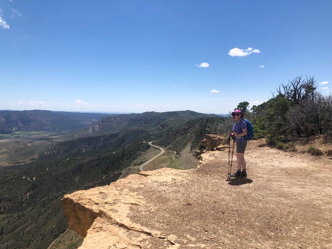
Similar to the Point Lookout Trail we hiked yesterday, the top flattens out with wide areas at the edges to look down into the canyons. It was now midafternoon, fully exposed and very hot, and we were ready to close the loop.

Spruce Canyon, Navajo Canyon and beyond

Satisfied with our adventures for today, we drove out of the park (another hour) back to our home base with time to visit the Cortez Cultural Center. It’s a community arts center featuring artifacts and exhibits of Native American and Western handicrafts, art, music and history. A staff person invited us to come back at 7pm for a demonstration of Native American dance.

We found dinner at Main Street Brewery & Restaurant, underwhelming food but extra points
 for the beer and creative taps

At the Cultural Center’s outdoor amphitheater, 30 or 40 people were gathered on concrete steps for the dance demonstration. Half a dozen men and women played drum beats as two adult women and several children of varying ages performed dances. The dancers wore intricate costumes of beading, shells and bells.

Between dances the narrator explained their stories and purposes. Everyone in the ensemble was his child or grandchild, and as the patriarch he has taken on the task of keeping the traditions alive for his people. The event ended with a group dance with audience participation. I’m so glad we had the opportunity for this! It left me wanting to explore more in this corner of Colorado.

"I have learned that the point of life's walk is not
 where or how far I have moved my feet
 but how I am moved in my heart."
 ~Anasazi Foundation, The Seven Paths: Changing One's Way of Walking In the World

Wednesday, September 6, 2023

Colorado 2022: Mesa Verde National Park & Point Lookout Hike

Colorado 2022: Mesa Verde National Park – 8/9/22 – 2.5 Miles

Breakfast on a road trip is usually coffee, yogurt and a cereal bar as Jim and I are itching to start the day’s hiking and sight-seeing. Today we changed it up (I know, aren’t we crazy kids?) by packing up and heading west on Highway 160 to Durango, CO.  [Staying in Durango last night would have been great, but that would have pushed an already long day.] 

The payoff: breakfast at the Durango Diner. Vintage, authentic, genuine, whatever you want to call it, this place is the real deal, pouring bottomless cups of coffee for more than 60 years. Photographs covered the walls floor to ceiling. A pay phone with an intact phone book hung on the wall.

We squeezed in at the counter to watch the organized chaos. The servers knew their stuff and the cooks knew how to keep things moving. Still, it took a little while to get our food because of the volume (table service and takeout orders too).

What would you like with that bottomless cup of coffee, hon?

Me: eggs & biscuits & gravy & home fries

Jim: the “Cure classic” signature dish, everything covered in green chili sauce
 (I couldn’t watch him eat it)

With full stomachs we continued west on Highway 160 and soon reached Mesa Verde National Park, a UNESCO World Heritage Site. Photos of Mesa Verde NP (MEVE) have long fascinated me. Aside from the breathtaking natural features of the mesas and canyons, the impact of human history lingers in thousands of archeological sites and 600 cliff dwellings in the canyon walls that were home to the Ancestral Pueblo (Anasazi) people.

Mesa Verde NP was the cornerstone of timing our entire Colorado road trip. Some of the larger sites had just reopened for guided tours after extensive shutdowns (“just” meaning the week of our visit) and we booked reservations to tour Cliff Palace on our second day. [The park website has a very helpful chart of drive times between features in the park so you don’t fool yourself into scheduling too much.]

Today was for driving and understanding the layout of the park without time constraints, hopefully a hike or two. After a stop at the Visitor Center, we began on the Park Road (well, the only road). Just two miles in, majestic Point Lookout rises from the valley floor, dominating the sky. What an entrance!

Okay, we’re convinced we need to get to the top without delay. Point Lookout Trail starts near the amphitheater beyond Morefield Campground. As we cruised through, we were surprised that the campground had few occupied sites. Maybe the mid-day transition time? With full services near the entrance (the only gas station, a camp store, restaurant and laundromat) it looks like a very comfortable base. [If you’re going, this is as far as trailers and towed vehicles are allowed. And if you’re not camping, there is a large vehicle parking area near the front entrance to the park.]

At the trailhead, just one other car (surprise again). Jim’s socks were still wet from yesterday’s crossing of Medano Creek at Great Sand Dunes NP, so he slid them onto the windshield wipers to dry while we hiked. (Doesn’t everyone do this?)

Another car pulled up as we were setting out, a seasonal employee of the Park. I was impressed that she hikes on her days off. She enthusiastically recommended the Petroglyph Point Trail on Chapin Mesa for tomorrow since Cliff Palace is nearby.

Point Lookout is 8,427 feet elevation, which explains my gasping for air on the climb. The trail started out level but quickly changed to steep short switchbacks that zigzagged up the mountain.

Looking back to the parking lot and Morefield Campground

Looking west – the pointy peak on the horizon is Ute Mountain

The trail delivered us to the mesa on the top of the mountain and led us through half a mile of scrub and twisted trees. Amazing wood sculptures! I am fascinated by the “bones” of dead trees.

Short side trails to the right lead to the cliff edge

Wide, flat, bare red dirt and then…nothing

Park Road slithering like a snake towards Mancos Valley

Trail’s end at the front tip of the mesa,
impossible to describe the feeling at the edge of a sheer drop

The steepness of the trail was just as challenging going down. To distract myself I counted switchbacks (28) and took many photos of flowers and rocks.

Indian paintbrush

Snakeweed

Jim’s socks were dry and we continued on Park Road. It’s similar to the Blue Ridge Parkway with overlooks and pulloffs. The difference is that the BRP was built for its own sake as an attraction through the Blue Ridge Mountains, while the Mesa Verde road was built to move people to artifacts and sites after the creation of the Park in 1906. The first short roadway was built in 1913. [Read more here.]

We passed through Morefield-Prater Tunnel and stopped at the Montezuma Valley Overlook, a short walk out to see an odd-looking formation called the Knife Edge. Before the tunnel was created, this was the passage of a rough road for horses and wagons and early cars to access the top of the mesa in the park. Hmmmm….

A park display at the trailhead explains: “A dirt road was completed in 1923. However, rock falls and landslides made the annual maintenance costs extremely high. This section of the road was abandoned in 1957 when the Morefield-Prater Tunnel was constructed. “

Looking southwest from Montezuma Valley Overlook, Ute Mountain again on the far horizon

Next stop, Park Point Lookout is at 8,572 feet elevation (couldn’t they think of something to better distinguish between this and Point Lookout Trail?) This is an active manned lookout tower, today “womanned” by a ranger who scans every 15 minutes for fires, storms, and other weather phenomena. 

A short trail north gives expansive views over the valley. We could see the town of Cortez to the west where we’ll be staying the next two nights. To the east we saw lightning and storm clouds releasing solid sheets of rain, moving towards us from the La Plata Mountains.

A short drive further to our last stop for today at Geologic Overlook (I’m getting the idea of simple names). There is only a pit toilet and a short trail to a different vantage point for watching storms forming and moving over the expansive Montezuma Valley. Don’t take these overlooks for granted, there is always something amazing to see!

Tomorrow we’ll return and drive deeper into the Park along Chapin Mesa. For now, we found our Airbnb in Cortez, a modest one-story home on a residential street, then wandered around the small town to find Wild Edge Brewing Collective on a side street. We listened to a lone musician playing Celtic music on guitar as we toasted to another fine day in Colorado.

"I want to stand as close to the edge as I can without going over. Out on the edge you see all kinds of things you can't see from the center."
 ~Kurt Vonnegut, Jr.