Showing posts with label Swamp Fox Passage. Show all posts

Monday, February 7, 2022

Palmetto Trail: Swamp Fox Passage & Awendaw Passage

Palmetto Trail: Swamp Fox Passage & Awendaw Passage – 4/3/21 – 12.7 Miles

How do you feel when you’ve got a loose end hanging out there on a hiking map? It may not bother you one bit, but for me it’s always just at the corner of my eye, pulling my attention away from whatever else I’m trying to do. Carol and I both wanted to finish up the Swamp Fox Passage of the Palmetto Trail and add on the Awendaw Passage to get us to the South Carolina coast. We were on a mission. The first chance we both had was early April…and away we go!

You will remember, dear reader, that our prior progress ended at Halfway Creek Road back in January. We had about 13 miles remaining, so we planned to camp at Halfway Creek the night before and get an early start on hike day.

We met at Buck Hall Recreation Area on the Intracoastal Waterway, about 32 miles north of Charleston. It’s part of Francis Marion National Forest and is also the eastern terminus of the Palmetto Trail. I moved my gear to Carol’s car and left mine patiently waiting our triumphant return.

We’d planned to eat dinner somewhere instead of cooking at camp, but the few restaurants that were open made us a little COVID-cautious. Ultimately we got takeout meals at McClellanville Diner on Highway 17, drove back to Buck Hall’s picnic area, and sat at a picnic table to eat and finalize our hike plans.

At the Halfway Creek camping area…is this really a camping area? No toilets of any kind, no running water, no electric outlets, and no fee station, just a gravel parking lot and tents set up at random. A couple of campers looked like they had been there a while.

So we walked in a little ways from the parking lot and set up, too, with one eye on a lone guy with a big bonfire and his cranked up car stereo. (He played his favorite song a few times throughout the night but I’m sure I slept some.) If you’re planning a trip, consider spending a few bucks and reserving a campsite at Buck Hall Rec Area.

In the morning we debated about leaving our tents up to dry but decided to pack everything up for a quick departure after our hike. We ate breakfast in the car, locked it up, and found our starting point. It looked a lot like the previous ones.

Another chilly start, but it warmed up a lot during the day

Frosty foliage

What’s different is more green, fewer puddles


Flame azalea

Cinnamon fern

Our final miles of Swamp Fox Passage were underwhelming compared to our previous hikes but we found glimpses of interest along the way. Carol used a flower ID app for foliage and emerging flowers. At this time she was taking a Master Naturalist certification course and I enjoyed hearing about what she was learning.

Bridge over Steed Creek – this creek flows south to join Bell Creek, and together they form
 Awendaw Lake (a very skinny 125-acre body of water) and Awendaw Creek

Fern growing on a cypress stump

Shortly after the bridge, the Swamp Fox takes a right turn towards its eastern terminus at Highway 17 and the Awendaw Passage continues straight (the trailhead parking to begin both sections is at Highway 17.) Carol and I continued straight to hike 6.5 miles on the Awendaw Passage.

After two miles of “business travel” getting across Highway 17 and down to the water's edge, we were introduced to magnificent Awendaw Creek and, across the way, the Intracoastal Waterway and Cape Romain National Wildlife Refuge. As the trail undulated alongside the creek, I felt a shift in mindset along with the change in scenery: anticipation and curiosity about what’s around the next bend.

Ugh – Can we get a bridge over Highway 17?

But then Carol would miss this chance to ID another flower in the middle of a divided highway

Dewberry

Wisteria – native or invasive? Hard for us to tell

Our first look at Awendaw Creek (looks more like a river to me)

Most of the trail between Mile 4 and Mile 2 follows the creek and the transition from pine forest  through coastal grasses to maritime forest of live oaks, shrubs and saw palmettos. Just scroll on through.


Taking a break on the boardwalk

Resurrection fern

As Awendaw Creek flows into the Intracoastal Waterway, the trail turns inland and passes through a pine forest to go around private land, then crosses Buck Hall Landing Road to a boardwalk for the last quarter mile to its terminus at the Recreation Area. 


Trail’s End

The timing was right for Carol and me to hike the Swamp Fox Passage in the wintertime, but finishing the section today gave us a taste of spring, especially the Awendaw Passage and especially with a Master Naturalist! As always, we have much appreciation for those who create, protect, preserve and conserve these lands.

“I think that I cannot preserve my health and spirits unless
 I spend four hours a day at least - and it is commonly more than that - sauntering through the woods
and over the hills and fields,
 absolutely free from all worldly engagements.”
~Henry David Thoreau


Thursday, February 3, 2022

Palmetto Trail: Swamp Fox Passage - Day 3

Palmetto Trail: Swamp Fox Passage – Day 3 – Eccles Church Road
to Halfway Creek Road & Steed Creek Road
1/30/21 – 14.1 Miles


Hardy hikers woke to a heavy frost coating our tents and the grass of our little churchyard. We left the tents up to dry out in the sunshine while we hike to Halfway Creek, and we’ll drive back in the afternoon to fetch everything. Layered up again, this time including long underwear (I ignored my rule of thumb that legs warm up fastest). We shivered at the thought of another cold breakfast sitting in the car, so Carol turned on the heat long enough to spoil us. But get going we must.

Morning light

From the campsite, we walked half a mile down the forest road to the trail’s right turn into the woods (eastbound today). In a few short minutes we were met by a backpacker! She’s an avid thru-hiker: the AT, the MST, who knows what else, and now the Palmetto Trail. She talked a blue streak, with detailed descriptions of soft feet and blisters and bubble baths, then on to the next topic that came to mind. I realized that she was not asking any questions of us other than how far we were going – did she mention that she was thru-hiking? I grew impatient to move along because it was so cold. We took photos for posterity and said goodbye. Carol commented that perhaps she was lonely. I felt remorseful and replied that I was carrying a big ol’ sack of judgment with me.

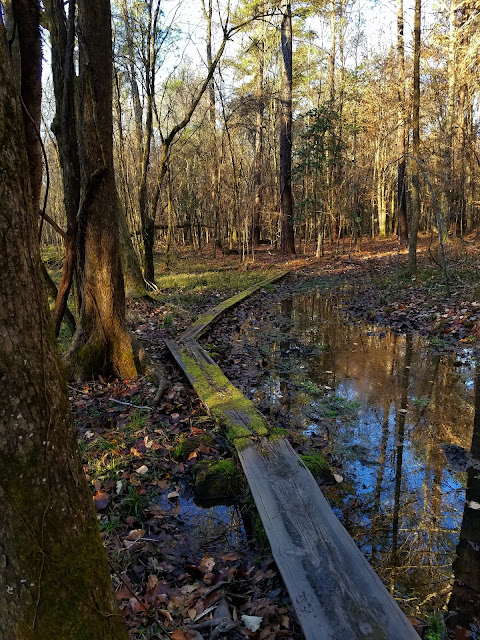
Overall, fewer wet sections today than yesterday and the trail got drier as we headed east, but whenever I grew accustomed to the dry stretches, a bog appeared around the next bend.

Near Mile 18 we passed the Turkey Creek campsite built by another Boy Scout. Our thru-hiker friend stayed there the previous night. I still think I would only camp in super cold weather to avoid the critters.

Oops, almost lost my bandana

Reflections


Hooded pitcher plants (until today we’d only seen decaying husks)

The day warmed up to the point where I removed my first three layers, considered taking off layer #4, and while we stopped for a break I took off my long underwear, hoping no one would come along. Felt MUCH better!

We walked through an extensive burned area today, very recent, no new growth rejuvenation yet. Fire is essential to the health of a forest. We speculated on whether it was a controlled burn or the result of a lightning strike or human carelessness. Sobering.

Dog Swamp was a large area labeled on our maps – whatcha got?  Nothing compared to what we’ve been through! The underbrush obscured the water that was surely there and we passed through without much comment.

The most beautiful spot today (IMO) was near Quimby Creek/Bennett Branch, a swamp filled with cypress trees standing like sentries (without knees) in clear reflecting waters. The still air, the glowing green moss, the tannic brown water was breathtaking. At the water’s edge I tried to get good photos, knowing that the essence could not be captured. 

As Carol and I were scouting for a lunch spot, we passed a Boy Scout troop clearing a space for an improved campsite. We walked half a mile past them to claim a space off the trail, within sight but not in the path of the guys walking back to their trucks for lunch.

[See what I did there…scouting…Pause to remind everyone that Carol and I first met as Girl Scout leaders taking outdoor skills training…more than a few years ago. I’ll always be grateful for what Scouting did for my kids and how it opened doors for me as an adult in the program.]

We crossed Halfway Creek Road at a parking area (not ours) where moms and friends were buzzing around preparing lunch for the Boy Scout troop. One nice young woman gave us Moon Pies – sweet! Swamp Fox trail magic!

Carol is checking the map – are we there yet?

The last mile-and-a-half to the end of our hike at Halfway Creek & Steed Creek Road was looonnngg and we were ready to be done. We encountered more and more people and asked a few if they knew tomorrow’s weather forecast. Each person confirmed that rain was coming.

We made our decision to head home at the end of today’s hike. We’ll camp at Halfway Creek when we meet again on a dry day in a few weeks to finish the last leg (6 miles of Swamp Fox Passage and 7 miles of Awendaw Passage.) For now, we returned to Eccles Church to pack up our dry gear and go our separate ways.

Carol and I are well matched in many ways as hiking partners, and a key aspect is that we set an understanding of flexibility from the start, so that neither of us gets frustrated with the other’s decisions [and Carol has an extra dose of tolerance.] Questions to talk about with someone you’re thinking of doing multi-day hikes with: Is this do-or-die? What kind of trail conditions/weather are a deal-breaker? What are the bailout options that won’t make anyone mad? What’s more important, the hike or the friendship? Hint: the trail will be there another day.

If you’re thinking of hiking the Swamp Fox Passage:

Learn some human history before you go

Learn some flora & fauna and/or use a flower ID app

Watch the light and appreciate the environment if it’s new to you

Plan for water supply – I’ve read that filters can get clogged easily so chemical purifiers are recommended. Although I have consumed water in the mountains using chemical purifiers, I wouldn’t want to drink the murky, potentially brackish water on the Swamp Fox Passage. Since we were car camping, we carried water each day from gallon jugs that we kept in our vehicles.

There’s more than one way to hike the Swamp Fox Trail. A great writeup is here.

"God never made an ugly landscape.
All that the sun shines on is beautiful,
so long as it is wild." 
~John Muir


Friday, January 28, 2022

Palmetto Trail: Swamp Fox Passage - Day 2

Palmetto Trail: Swamp Fox Passage – Day 2 - Eccles Church Road to Cordesville Road
1/29/21 - 15.5 Miles

Looks like 11 hours is my maximum tolerance for staying inside a tent. I slept well (can’t remember if I got up to pee?) but once again I was wide awake by 6:00 a.m. Carol was also stirring in her tent. Soon we were dressed and enjoying a cold breakfast in her car, because nobody wants to take off gloves to light a backpacking stove on a frigid morning. Carol had brought cold-brewed coffee from home and I was satisfied with yogurt and a Clif bar to get me started.

By 7:30 a.m. we were ready to move, anticipating a similar day on the Swamp Fox Trail. One difference, though, was the significant drop in temperature – a very cold start. My layered ensemble: short sleeve shirt, long sleeve lightweight shirt, quarter-zip Smartwool long sleeve, lightweight black fleece, puffy jacket, thick wool gloves, and a fleece headband under my Liberty hat. I skipped long underwear, opted for my rain pants. My legs are the first body parts to warm up and it's easy to get out of the rain pants. Carol wore a layered combo as well. [This was not our first chill rodeo.]

Still, it took quite a while for my fingers to warm up.

Today we hiked westbound again, from just before Mile 19 to Mile 33 at Cordeville Road where my car was (hopefully still) parked. For our first seven miles, the trail ran concurrently with the Jericho Horse Trail (it’s a 19-mile loop).

Creeks run everywhere through the Lowcountry, all heading to the coast, creating swamps and marshes. Creek names describe the wildlife, the terrain, sometimes the landowners and human occupants: Alligator Creek, Turkey Creek, Jericho Branch, Bullhead Run, Negro Field Branch.

Disclaimer: I have not researched extensively and can’t cite sources, but I’ve learned generally that rice plantations in Berkeley County (for example, Jericho and Windsor) used Jericho Swamp, Hell Hole Swamp, and others as primary water sources to cultivate their rice fields.

Our first three miles today followed Turkey Creek. The early morning light felt ethereal, created just for us. When you think about it, all of nature is created for anyone who is open to it.

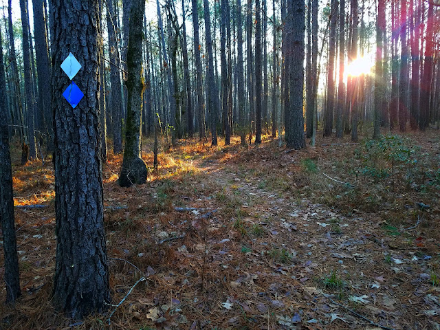
White blaze is the Swamp Fox Trail, blue blaze is the Jericho Horse Trail

The trail was a little wet to start but overall in better condition than yesterday, more muddy than deep water, some edge walking but less bushwhacking. Due to one more day of drying out?

Around Mile 22, still following Jericho Horse Trail, we emerged from the pines, crossed SC 41, and re-entered the forest. The trail made a 90-degree right turn to commence a 4-mile-long, perfectly straight path on a raised converted rail bed with swamps and water-filled ditches on either side. What at first seemed interesting and unusual became monotonous and never-ending. There was nary a dry place to take a discreet pee break.

Crossing Fox Gully Branch

We crossed numerous forest roads today, some multiple times, and I was grateful to have the GAIA app to keep oriented. [Note: Road names were also clues to local wildlife encounters: Yellow Jacket Road, Copperhead Road, etc.]

Past Mile 24 there was a dam-like crossing of Hell Hole Swamp, a wide raised concrete walkway bordered by granite boulders. We were looking for a sunny spot for a lunch break, so we stopped at the midpoint. 

[The name “Hell Hole” is fun to say and capitalize on. Check out the Hell Hole Swamp Festival, 5K, parade and Miss Hell Hole Swamp Festival Beauty Pageant.]

Crossing Nicholson Branch

A few hundred yards past the bridge (much closer than I thought it would be) we discovered the Nicholson Creek campsite with comfortable benches – haha! But we’d enjoyed sitting in the sun on the boulders at the dam.

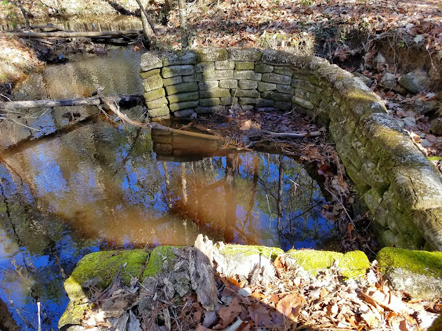
An intriguing stone structure with curved corners, looks like the foundation of a building,
haven’t found any info about this

At Mile 26, Swamp Fox Trail takes a sharp 45-degree left turn and parts ways with Jericho Horse Trail, crossing Witherbee Road and beginning another run of 4 relatively straight miles. We were closer than ever to civilization, walking behind homes, then past Witherbee Campground and across the CSX Rail Line. We also passed through Little Hellhole Reserve, a birding mecca of the Francis Marion National Forest.

The last two miles to my car at Cordeville (yay, it’s still there!) were soft pine needles and easy boardwalks.


Carol and I returned to our base camp at Eccles Church at 2:15 p.m. We’d hiked 15.5 miles in 6.5 hours, including breaks. We chilled out for an hour, took off our shoes, changed clothes, ate a snack, and positioned our camp chairs to bask in the sun. It was a reward we don’t often give ourselves.

We’re staying at Eccles Church again tonight. After our indulgent siesta, we moved my car to tomorrow’s campsite at Mile 6 on Halfway Creek Road, with the plan to hike eastbound from Eccles Church to there tomorrow. We’ll miss the quiet isolation of our little churchyard home!

Hmmm…significant rain is in the weather forecast after tomorrow. If the trail is already as wet as we’ve seen, do we want to walk the last 13 miles of it in the rain? We’ll discuss and decide as we hike tomorrow.

After placing my car, we returned to the church and settled in as the temperature plummeted with the sunset. Carol set out her stove to boil water for supper, commenting, “Geez, it’s only 5:20!” Combining backpacking with the luxury of car camping where you throw everything in the trunk “just in case,” we ate snacks from our generous stashes we’d brought while we made hot backpacker meals. Carol treated herself to hot chocolate and I sipped fruity hot tea, my end-of-day camping tradition.

Near dusk we noticed two glowing lights in the church cemetery – shall we investigate? I don’t know of anyone other than Carol that I would do that with without feeling apprehensive. Why? I guess I trust her – a lot!

We didn’t explore the back corners of the graveyard, but the front couple of rows looked very well cared for, with mementos left on the tombstones. The lights were solar lanterns that family members had left on two graves, one a simple light and the other one a glowing Jesus figure.

In our tents before 7:00 PM because it was cold, but I wasn’t worried about sleeping warm tonight because I’ve figured out the system. I’d brought an extra thick fleece blanket (car camping!) to pull over my sleeping bag. Even getting up to pee was okay because I could look forward to crawling back into the warm cocoon. Temp went down to 28 degrees.


“Enjoy the little things, for one day you may look back and realize they were the big things.”

 ~Robert Brault