Showing posts with label Grandfather Mountain State Park. Show all posts

Tuesday, December 8, 2020

Grandfather Mountain State Park: Popsicle Toes Hike to Calloway Peak


Grandfather Mountain State Park: Popsicle Toes Hike to Calloway Peak
2/1/20 – 8.3 Miles 

Popsicle Toes: Every year, Rick leads this winter hike for the Carolina Berg Wanderers.  It includes the Daniel Boone Scout Trail where I’d had an injury in June 2017, so I was eager to revisit the scene. We were a party of five: Rick, Cathy, Mike, Jim and me. 

Jim and I drove up from Charlotte early Saturday morning. Rick advised meeting at the Asutsi Trailhead, which is the only access to Grandfather’s east side trails when the BRP is closed – and Rick was right.  The temp at our start was in the 30’s with snow showers predicted for the afternoon. There was already a trace on the ground to get us pumped up, but our imagination fell far short of what awaited high on the mountain. This would be a hike we'll talk about in our rocking chairs by the fireside.

Here you’ll find great descriptions of the east side trails.

From the parking area, the .4-mile Asutsi Trail leads under the BRP and connects to the Tanawha Trail, where we turned left. The trace of snow quickly became an inch of white stuff.

Footbridge crossing Boone Fork

A quarter-mile along the Tanawha Trail we turned right onto Nuwati Trail for a steep climb (enjoy it now because we will descend by a gentler route). I didn’t feel winded from the effort – in fact, it felt refreshing to be outside, bundled up and hiking on a cold day. As the snow deepened, we slowed down to be careful with our footsteps.

Halfway up Nuwati Trail, we took a left turn onto Cragway Trail, a one-mile connector to Daniel Boone Scout Trail. The blustery wind in exposed areas pushed us to get back in the safety of the trees, but the elevation gain never felt taxing: there was no hurry. The snow was now sticking to the leaves and bare branches and I wanted to see it all.

Rick in the haze near Top Craig View

At Flat Rock, we turned right onto Daniel Boone Scout Trail and the climbing began again with two miles to go to Calloway Peak deep in the trees now, almost no wind. My lightweight fleece was getting damp from brushing against the bushes, so I removed it and put on my red rain jacket. Fresh snow was several inches deep on the trail, covering rocks and roots. Footprints of early bird hikers led the way.

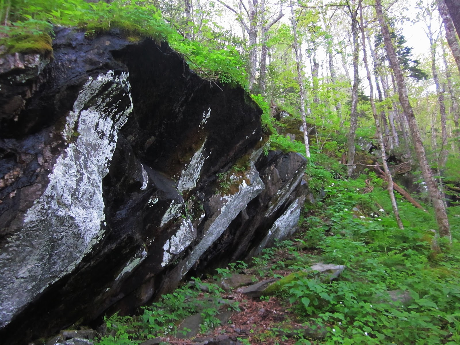
As we passed the Daniel Boone campsite I began to anticipate seeing my nemesis, the large rock surface where I had slipped and broken my shoulder on a sunny summer day…but my memory was fuzzy and everything looked different under this cotton-white blanket. Every turn in the trail was a new wonder, snow clumping on evergreen branches, clinging to the rhododendron leaves and stems of brown grasses. I gave in to the present moment.

We met the owners of the footprints as they came back down the mountain, one wearing shorts and hauling a seriously overloaded backpack (a training hike). They said the first ladder to the summit of Calloway Peak was covered in ice, so they turned back. Well, we knew that was a possibility, and we made an agreement that we would do likewise if it looked unsafe. For now, let’s continue to enjoy the day!

At 1:00 pm we stopped for a short break at Hi Balsam Shelter, a few dozen yards off trail to the left. Hi Balsam is an old 3-sided log shelter with the lowest overhang I’ve ever seen - Rick had to bend fully at the waist to duck underneath it. We ate lunch and got thoroughly chilled. We slipped crampons/snow spikes onto our boots for traction in anticipation of ever-deepening snow and hidden ice.

A cold day for the rhodies

 On May 5, 1978, a Cessna 182Q crashed near the foot of Grandfather Mountain’s Calloway Peak. The unnamed lone pilot perished. The remains of the plane are visible from the trail if you are alert for them. A short distance up from Hi Balsam, Cathy spotted a dull yellow color and footprints in the snow several yards to the right of the trail. The remnants of metal were sobering, so small and desolate, coated in snow.

Rick & me

And there was the ladder, looking beautiful and intimidating and beckoning us to be brave.

Do we turn around? Do we try it? Curious Cathy stepped on the first rung, then the second, and reported that they were not exactly icy. The ladder was snow-covered, but sturdy, and with slow careful steps we all climbed up, trying not to think about going back down.

Let's go for it!

The second ladder was taller and the top four rungs were leaning against dirt, covered in snow, with no way to wrap glove-covered hands around the rungs. At the top of this one, a cable was bolted to 30 feet of rock wall, to enhance that feeling of safety I did not have.

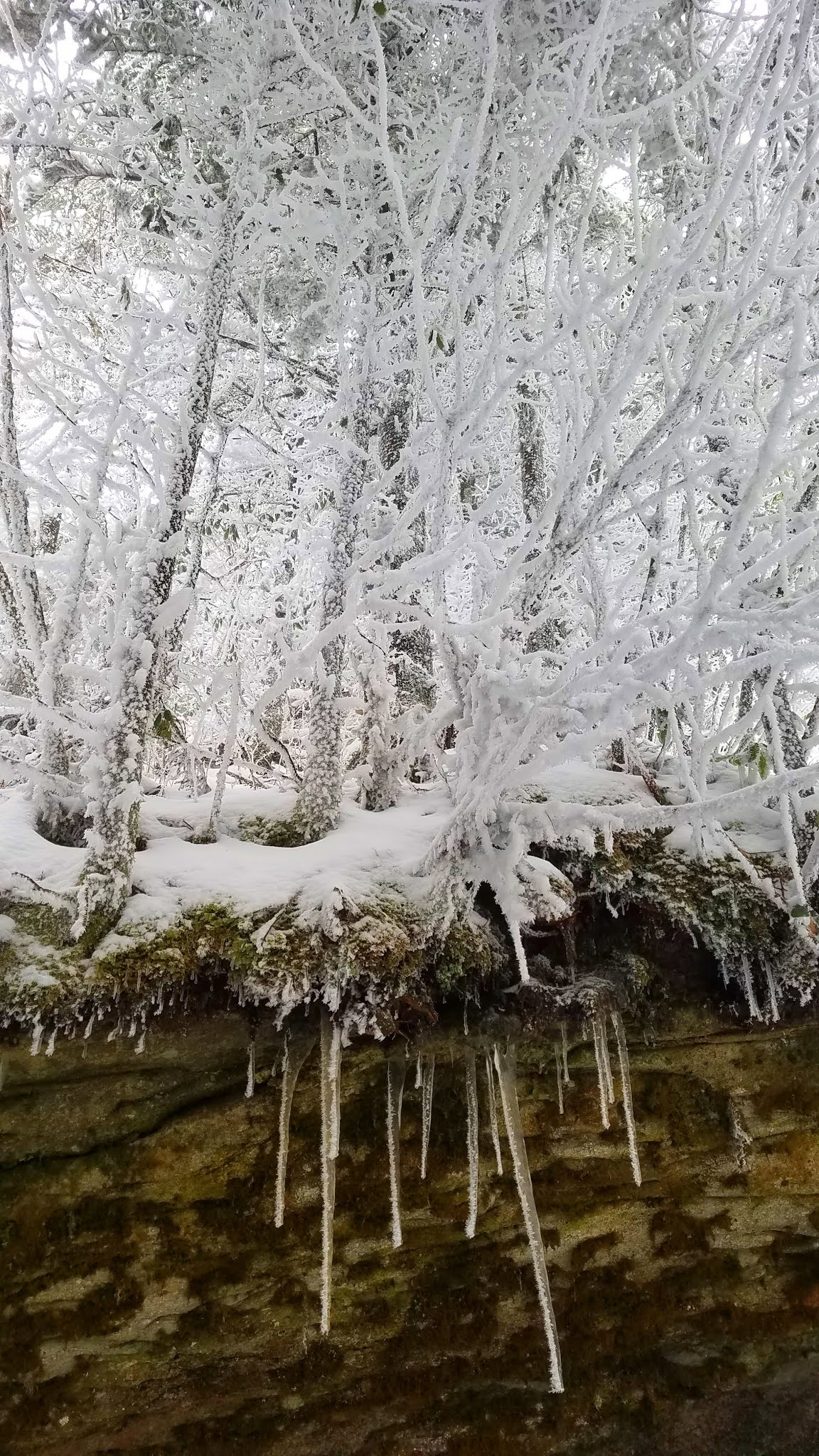
As Rick and I waited our turn on the second ladder, we were awestruck by white wrapped around every small branch, like a coating of ice but soft like snow, as though the wind had blown the snowflakes sideways. Long icicles hung down from the embankment as if they were roots of snow-covered trees growing above.

The third ladder was shorter, leaning at a daunting 60 degrees, but we're all in now.

The trail continued another 100 yards, moderately steep so still claiming our attention.  Suddenly we popped out onto Calloway Peak (5,964 feet). We were enveloped in a cloud, visibility just to the nearest trees, the sky a steely light blue-gray…a non-color…like nothing I had ever experienced before. The stunted evergreen trees had been dipped in white chocolate. The wind was not gale force, but stiff enough to make us shiver and quickly take photos in group combinations like a wedding party trying to get to the open bar reception.  

Going back down the ladders, we took our sweet time with photos and videos, and when one would act too confident, the rest would remind us how cold it would be waiting for a rescue.

Obstacles overcome, we moved quickly on our four-mile descent, spreading out and each moving with his or her own thoughts. Fresh snow absorbs sound, and I found myself alone somewhere between Jim and Rick. I stopped and listened to absolute silence.

Staying on Daniel Boone Scout Trail, we bypassed Cragway Trail. At lower elevation the snow thinned and tree roots and rocks reappeared. We took off our crampons. My right knee began to complain of the relentless downhill. We turned left onto Tanawah Trail, right on Asutsi Trail, back to the parking lot.

Did we really just do that??? We'll be telling this story around the campfire for years to come.

Everyone safe and accounted for - this group needs pizza and adult beverages!

“When snow falls, nature listens.” 
~Antoinette van Kleef


Monday, July 2, 2018

Grandfather Mountain State Park: Uh-Oh


Grandfather Mountain State Park:  Uh-Oh - 6/24/17 – 5 Miles

 
Still in training for our fast-approaching AT hiking trip in Maine.  Jim was participating in a cycling event in Boone, NC on Saturday, staying at a cycling friend’s house.  I tagged along.  Early Saturday morning when Jim and Rike left for their ride, Rike’s wife Tammy and I went hiking at Grandfather Mountain State Park.  Our goal was finding the remains of a plane crash near the Daniel Boone Scout Trail. 

Sunshiny hot day, galax blooming profusely, not many people on the trails yet, a little bit of dampness left from the previous night’s rain.  Everything was great – until it wasn’t.


Tammy walked nimbly up this sloped rock face and I followed diagonally up the middle crack, keeping one hand on the higher ledge and holding my hiking poles in the other.  I paused and said, “This is going to be hard to come back down” (not exactly in those words). My hiking poles were hindering me and I wished I could toss them out of the way.  At that same moment, my left foot slipped on the wet surface and I fell forward – hard.  I thought, I’m about to break my nose on this rock. 

I landed full face down and slid on my stomach to the tree at the edge of the rock.  My nose was spared, as were my teeth, but my lip was bloody.  I tried to get up, but my left arm wasn’t cooperating. I wrangled around the other way to a sitting position.  Tammy hadn’t seen me fall but she had certainly heard it. She hurried over to me and tentatively asked, “Are you okay?”

Well, let’s see.  I remembered from a wilderness first aid course many years ago that the first thing you do is nothing, just stay still and assess the situation. I had some impressive scrapes on my legs.  My bleeding lip gave the appearance of a Walking Dead extra.  The big problem was my left arm:  I found that I could bend it at the elbow but could not move it from the shoulder.  Maybe it’s just badly bruised? Clearly our hike plan was turning around. 


Turning around and hiking out 2.5 miles.  Holding my arm immobile across my chest was going to be difficult, so we made a primitive sling out of my bandanna (thank you, Girl Scouts training) and I used one hiking pole while Tammy took the other.  She was calm, cool and collected through this entire process (a medical professional). Two-and-a-half miles gently and steadily downhill, not too bad, but occasionally I stumbled on a rock or root, my arm zinged with pain, and Tammy cringed just a little.  We kept up a steady chatter of distraction, even talked about recipes, until we arrived back at the parking area.

We called the guys, who had completed their bike race, and met them at the house.  Tammy fixed me up with a really good sling and we drove back to Charlotte rather than go through the ER in Boone. 

Verdict:  shoulder broken in two places, including the humeral head.  Treatment was to stay in a sling for 4 weeks. No AT hiking in Maine for me.


(Note: This occurred one year ago. After several months of doing nothing and then serious physical therapy, I’ve recovered 99% range of motion; it’s a little harder to scratch my back!) 

“Always watch where you are going. Otherwise, you may step on a piece of the Forest that was left out by mistake.” ~Winnie-the-Pooh

Monday, July 6, 2015

Grandfather Mountain: Profile Trail & Calloway Peak


Grandfather Mountain State Park – 5/1/15 - Profile Trail/Callaway Peak – 7 Miles

Something rustling in the dark… Is that a mouse?  No, it’s Jim up very early getting ready for his big bike challenge.  We had to get organized and leave our hotel room at crack-of-dawn-thirty.  He planned to ride his bike to the starting line in Banner Elk and I wanted to be far out of the way when hundreds of cyclists swarmed the roads.  A hike at Grandfather Mountain would entertain me for just the right amount of time to return to the finish line at the top of Beech Mountain.

Gearing up for the Beech Mountain Metric

Although I’ve lived in North Carolina for 34 years, I have avoided hiking at Grandfather Mountain because the weather is such a significant factor.  Wintertime means extreme cold, record-breaking wind gusts and icy conditions.  Summertime means quickly developing thunderstorms with too little time to get off the exposed rocky areas at the summits.  Spring and fall – well, it’s always crowded.  I did hike there once in late 2013 and found the trail to be arduous and slow going.  But today I was in the neighborhood, so I sucked it up with the attitude that I’ll get however far I get and be ready to bail out. 

Most NC state parks are free, but Grandfather was formerly privately owned and has infrastructure and substantial maintenance needs, so a fee is charged at the main entrance.  Then you can drive on up to the Mile High Swinging Bridge and restaurant and various trailheads.  However, if you’re willing to walk, the Profile Trail access on Highway 105 is free.  Get there early.


What a glorious morning!  The trail was lush and meticulously maintained.  I noted many wildflowers that I saw at Big Creek in GSMNP a few weeks ago, plus a couple of new ones like rosy twisted stalk and large flowered bellwort.

Jack-in-the-pulpit

Foamflower

The spotlight flower of the day was umbrella leaf in full flower, its enormous leaves blanketing the sloping mountainside

Each bloom more intricate and beautiful than the one before

Okay, now I’ll stop!

The elevation gradually steepened and I slowed down.  Boulders began to appear alongside the trail.

The namesake attraction of the trail:  the Profile.  On my way back down I met a cute young couple here and took their picture.  They were very excited because this was their second hike – EVER (their first was Crowders Mountain).  They were from the NC coast. 

Some impressive stone and trail work on a section called “Peregrine’s Flight”

White violets lining the trail

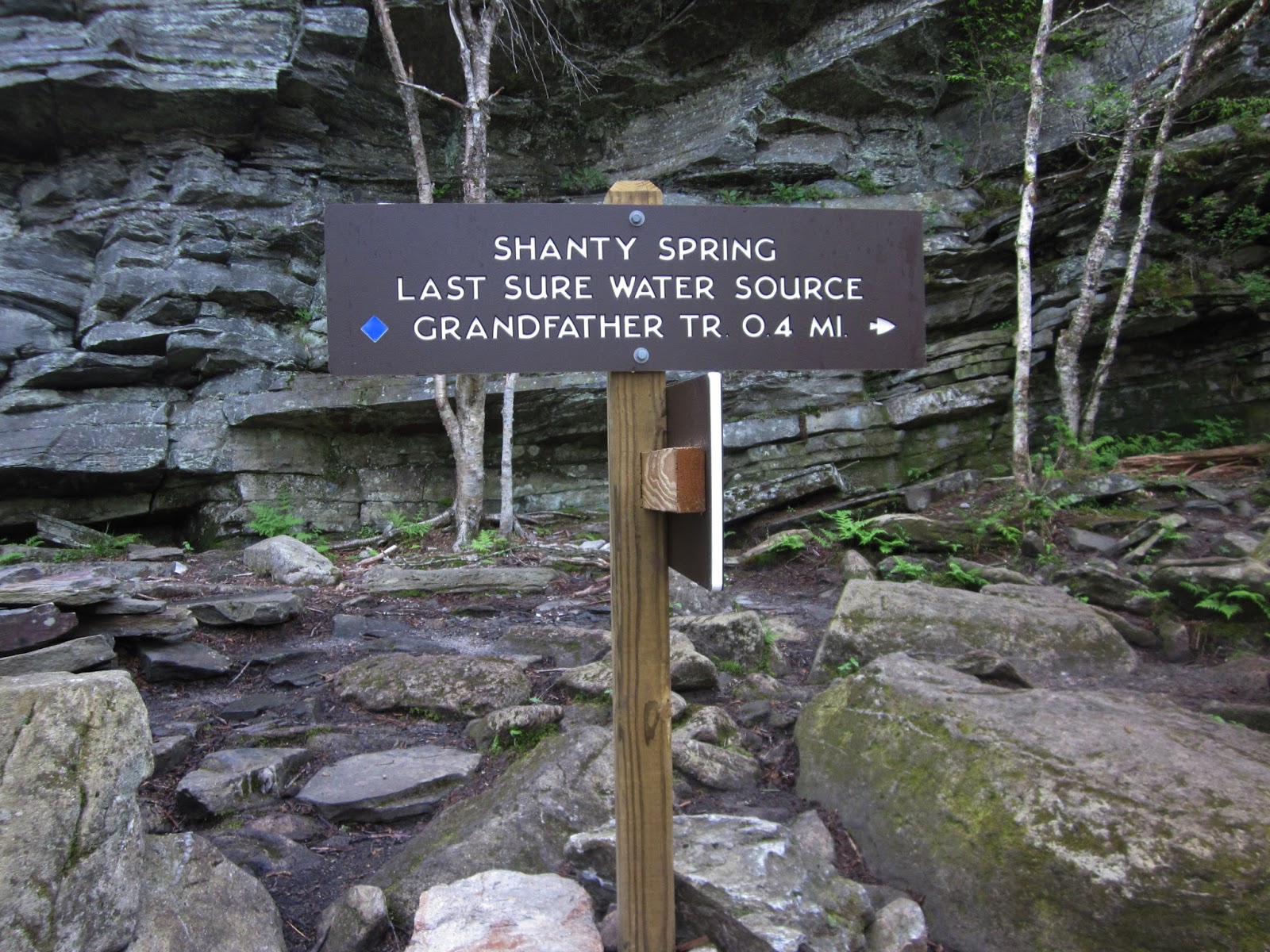
At Shanty Spring – hope you have enough water! 

The last .4 miles to the top of the Profile Trail has a seriously different character than the lower section.  The grade is extremely steep and climbs up a field of large boulders.  Why don’t I have any pictures of this?  I was working too hard! 

At the intersection of the Profile Trail and the Grandfather Trail, the morning was still young so I turned left to continue on to Calloway Peak, the 5,964-foot high point of Grandfather Mountain.  Still going up, of course, and this .4-mile section features some ladders and rock scrambling.  At this elevation the forest features spruce and fir trees and I spotted a couple of late-blooming painted trilliums.


If you do this hike, don’t skip the little side jaunt to Watauga View just a short distance from Calloway Peak summit.  On this clear day I was more than a little excited at this view featuring a faint Hawksbill and Table Rock on the horizon (they look like cat's ears).  I have seen these two iconic peaks from many points in my hiking life, especially during my Mountains-To-Sea Trail days. 

Creamy white witch-hobble blooming at Watauga View

At the summit of Calloway Peak, looking at MacRae Peak (which also features a little-bit-scary ladder climb). 

There were half a dozen hikers at the peak and more on the way so I didn’t linger.  I had a timetable to get back to meet up with Jim.  The hike back down the rocks was a challenge in reverse.  I met about 30 people on the return, many of them asking me how far to the top and was it worth it.  I tried not to judge those who had on flip flops and were talking on their cell phones.  They would learn a lesson without my input. 

At the parking lot, the rangers had closed access and were directing cars away.  Again, get there early!  Driving back to up Beech Mountain, I slowly and cautiously passed weary cyclists on their insane climb to the finish line.  I decided that I like hiking best. 


“Those who dwell among the beauties and mysteries of the earth are never alone or weary of life.”  ~Rachel Carson