
Showing posts with label Mount Mitchell State Park. Show all posts

Monday, June 21, 2021

Mount Mitchell State Park: Maple Camp Bald Loop

Mount Mitchell State Park – Maple Camp Bald Loop – 7/17/20 – 8.3 miles


Browsing my shelf of hiking guidebooks for a training hike for my upcoming John Muir Trail adventure, Danny Bernstein's stellar Hiking North Carolina's Blue Ridge Mountains offered up a loop hike in Mount Mitchell State Park. I wanted something interesting, physically challenging, and within a reasonable distance from home. As Meatloaf famously sang, "Two out of three ain't bad."

Jim tagged along, good sport that he is, to help me with the six-hour roundtrip drive and for safety on the hike. The terrain in Mount Mitchell NP is no joke, and weather can change rapidly and more severely than in many places that I'm comfortable hiking solo. Plus I enjoy having him around.

We opted to tackle the loop going clockwise, in the opposite direction of Danny’s narrative, to hike on the ridgeline first and avoid two things: more people later in the day and exposure to possible afternoon thunderstorms.
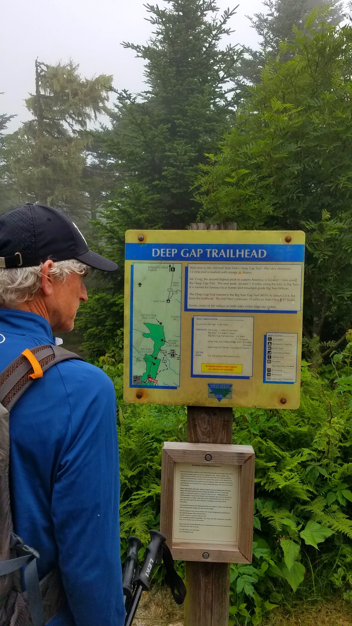

From the parking lot, Deep Gap Trail leads through the picnic area and into a Hansel and Gretel alpine forest, misty and cool, with secret moss-covered places for storybook creatures to hide. I’m sure we added an hour to this hike just by taking photos.

The view from the top of Mount Craig - 6,650 feet

Deep Gap Trail continues its ramble eastward along the ridgeline, an ever-so-slight downhill to the summit of Big Tom at 6,580 feet. These two peaks and several more 6,000 footers are lined up along the Black Mountain Crest. I’ve hiked them before as part of the South Beyond 6000 Challenge.


Michaux’s saxifrage growing in mossy spots

I remembered that the trail was rugged, yet I was still surprised by the big boulders and roots and intimidated by the ropes set in place for ascending and descending Big Tom’s slippery rock faces. 


Looking back up at what we just scrambled down

We turned right off of Deep Gap Trail, plunging steeply downhill on Big Tom Gap Trail (#191-A), which sees far less foot traffic. It was narrow, poorly marked, and alternated between piles of rocks and overgrown tall grass such that we couldn’t see our footing.  Jim was especially good at stepping into holes and yelping. This trail wasn’t long but it was ornery.

At the intersection with Buncombe Horse Trail we paused for a snack break, then turned left to follow Danny's directions to Maple Camp Bald. This trail was even less traveled, and since we were following the route in a different direction and weren’t checking mileage, it was challenging to determine when we had reached our destination. The vegetation was nearly chest high, which afforded the opportunity to enjoy the profusion of yellow flowers.

St. John’s Wort

Whorled loosestrife

Southern bush honeysuckle


Looking across the South Toe River valley towards the Blacks – are they on fire?
No, but those gathering clouds got our attention.


We arrived at a campsite with a nice view – could this be Maple Camp Bald? The “bald” is very broad and we couldn’t find a summit marker. We kept going for a bit, then turned back,
figuring we had done our best.

Buncombe Horse Trail was wide and very flat, rocky as to be expected, and required paying attention to navigate muddy spots. At this level of alpine elevation, the temperature was cool and comfortable (unlike our home in Charlotte, sweltering in the 90-plus degree heat).  Those dark clouds were concerning, and persistent thunder rumbled for the couple of hours we were on this trail, but they didn’t produce any wind or rain. (On our drive home we saw evidence of lots of rain in the valley.)

Galax

Surprise of the day – one purple fringed orchid

We stopped for a quick lunch at a campsite near the junction of the Buncombe Horse Trail and the Mountains-To-Sea Trail. With less than two miles to go, it was tempting to just keep pushing, but I’m glad we stopped to eat and rest. We had a big job ahead of us climbing up Mount Mitchell.

The MST runs concurrently with Mount Mitchell Trail and I’ve hiked this section several times, both up and down. It is seriously steep, unforgiving terrain, with encouraging (or discouraging) signposts of elevation progress (ex. 5900, 6250, etc.) It is a mental challenge as well as a physical one. The best advice I have is to go at your own pace. In total, the trail is about an 800-foot elevation gain in 1.6 miles, and Jim and I completed it in exactly one hour.

As we neared the parking area, we met the flow of people just getting onto the trails. It was a good decision to hike clockwise for more solitude. [We saw only five hikers on Deep Gap Trail and no one else until those folks near the end of the loop.] It was just good luck that thunderstorms never developed while we on the trail.

We stopped at a little brewery in the town of Marion to see if they were COVID-friendly (yes). Jim loves trying local beers and I’m happy that most places now offer ciders too. Mica Brewing had one of my favorites from Wisconsin on tap: Ciderboys Peach County! We toasted Danny’s contributions to the hiking world and another safe, magical day in the North Carolina mountains.

“The world is big and I want to have
a good look at it before it gets dark.”
~John Muir


Wednesday, May 22, 2019

Mount Mitchell to Montreat


Mount Mitchell to Montreat – 8/11/18 – 15.4 Miles


Months in advance, Danny Bernstein put out an invitation for a rare opportunity. With enough willing participants, she offered to arrange a shuttle bus and driver to take us from Montreat College up to Mount Mitchell so that we could walk one way, mostly downhill, via the Mountains-to-Sea Trail and the Old Mitchell Toll Road. My hand went up immediately – yes, please! 

I left my home in Charlotte at 5:30 a.m. to be on time for the 8:00 a.m. departure from Montreat. I drove under overcast skies with some wispy fog, a little bit of rain – not to worry, often the tops of the Black Mountains are above the clouds. And yes, we’ll hike in the rain anyway.

Members of Carolina Mountain Club and other hiking friends from all over western North Carolina - Weaverville, Maggie Valley, Asheville, Hendersonville, Arden, Charlotte – gathered eager to meet the challenge.  Every seat filled, all (14) present and accounted for, we left Montreat five minutes early! Lots of chatty people on the ride, running commentary mostly on health and hiking – does everyone have enough Ibuprofen for this downhill trek?

When the bus reached the Blue Ridge Parkway, we popped out above the clouds. No stopping for the view – we had a hike to get to – but I grabbed a couple of photos from my window seat.

At the summit of Mount Mitchell for our “before” photo

And we’re off on the Mountains-to-Sea Trail westbound, immediately starting a steep descent on wet, slippery roots and rocks. This demanded my full concentration, but the chatty folks kept up their conversations. We were clumped together, hiking too close to one another for my comfort (if I stopped suddenly I would surely get bumped from behind). I perceived this was the culture of the group and I was a guest, so I kept quiet and hoped this regimentation would loosen up as we went along.


On the plus side, this group was fit and well suited to the demands of the day, representing a myriad of experiences, including SB6K completers, AT section hikers and completers, Smokies 900, Pisgah 400, and several Camino de Santiago pilgrims. There really WAS a lot to talk about!

After one mile and 800 feet downhill, the trail moderated to a mercifully flat grade as the MST passed Camp Alice and made its way to Highway 128. We crossed streams and cascades, and late summer wildflowers like love pink turtleheads, love vine, St. John’s wort and goldenglow cheered us on. Debate topic: milkweed or Joe Pye weed? 
 

At Highway 128 our attention was captured by six-foot-tall blooming swamp-thistles topped with graceful butterflies. Paparazzi!


Here we left the MST behind and walked on the shoulder of Hwy 128 to its intersection with the Parkway, where we turned left/northbound for a lunch break at Ridge Junction Overlook. Notice the brooding clouds moving in again.


We continued a short distance on the Parkway as Danny kept an eye out on the right-hand side for a gated road that begins the Old Mitchell Toll Road (originally a tourist railroad access to the mountain and Camp Alice around 1915-1919, later paved as a tourist car toll road in the 1920’s, until the BRP was completed in 1939, providing free access). Great article here.

No signage at the gate.  One more group photo to prove that we made it this far.

One minute later we heard the rain coming, quickly put on pack covers and hustled into rain gear as a downpour ensued. Within 20 minutes we had walked through it, but I kept my rain jacket on for quite a while.  Level walking on the old toll road, almost imperceptible downhill, taking in the rain-filled puddles, the green of late summer and continued abundance of flowers: Michaux’s saxifrage, yellow coneflower, wood aster, white bee balm, spiderwort, and gorgeous yellow fringed orchids.

 
We passed some signed intersections, some unsigned, which was cause for discussion and verification. Danny had scouted most of today’s hike and felt secure in her information, and she was the only hiker who carried a map of the route. I was under the (mistaken) impression that it was advertised as an 11-mile hike, but it clocked in at more than 15 miles. I rarely hike without my own map and I’m not sure why I didn’t have one today. Preparedness lesson re-learned. 

The group stretched out on level ground and I stayed in the middle with some distance for solitude. Conversations still floated within earshot and I could tune in or out.  Hearing about Camino experiences was interesting, viewpoints for walking it solo or walking with a group of friends. I haven’t been particularly interested in being away from home for a long stretch, but maybe I need to think about this some more. 

Folks once lived along the old toll road. We passed a stretch of abandoned campers and makeshift cabins. No communal buildings, no church. Where did the residents work? How did they get food? Was the surrounding land once clear for livestock and gardens? Where was the school for the children? 

Mountain bikers out for a great ride

Below Pot Cove Gap we passed a hunting camp that is still actively used. Its owners/members and the town of Montreat share the gravel road for access.


The majority of miles were behind us but we knew there was a significant drop in elevation still to come. At Sourwood Gap, the rain returned.  We geared up again and turned off Old Mitchell Toll Road onto Appalachian Way, a steep gravel road that turns to pavement as it enters the Montreat community.  No rocks or roots, no steps, just a steep grade of loose gravel – ugh! Teeth were gritted and thighs were burning, putting on the brakes and grimacing with each step. The last mile was over 1,300 feet elevation loss. Ouch.

Smiles in the parking lot, though, and congratulations all around for our accomplishment.  Most of the group met for a pizza supper, but I headed back to Charlotte with some daylight. In my driveway, I could barely unfold myself out of the car. A hard cider, a kitty cat, ice bags on both knees, and Netflix – yes, please!

   
Stats from a fellow hiker:  15.4 Miles  Total ascent: 302 feet   Total descent: 4,276 feet  7.5 hours

“When you have worn out your shoes, the strength of the shoe leather has passed into the fiber of your body. I measure your health by the number of shoes and hats and clothes you have worn out.” ~Ralph Waldo Emerson