Showing posts with label Hanging Rock State Park. Show all posts

Thursday, January 11, 2024

Hanging Rock State Park: Indian Creek Trail & Riverbluffs Trail

Hanging Rock State Park: Indian Creek Trail & Riverbluffs Trail – 2/24/23 – 9.3 Miles

My Centennial Trail thru-hike is a tad more than 3 months away. Most of my training outings are on familiar trails that I don’t blog about. Jim offered to hike with me today, so we explored some new-to-me trails in Hanging Rock State Park.

A blue-sky day in February, pleasant hiking weather in the NC mountains, starting out with long pants and sleeves and ending in shorts. I carried my usual daypack with some extra weight. Soon I’ll start carrying my new Gossamer Gear backpack.

Starting at the Dan River boat access parking at the “bottom” of the mountain, we headed up Indian Creek Trail (I wonder if they will rename that one day?)

Canoe/kayak launch at Dan River

Boy Scouts? Parks and Rec? Random people?

Like the trail’s name implies, we encountered a lot of creek crossings. I suspect they are usually unremarkable rock hops, but there’s been a significant amount of rain lately. Let’s count ‘em up: 4 wet crossings plus 5 dry rock hop crossings adds up to 9 going up…plus 9 coming back down…that means 18 crossings that got our attention.

Jim was able to keep his boots from being completely submerged, but I had no chance of staying dry wearing my little Altra Timps. It was a nice day, though, and wet feet didn’t hinder me. Just happy to be outside!

The trail turned away from the creek and began climbing. A partially collapsed wooden building appeared near the crossing of Hanging Rock Road. Growing up in rural southern Virginia where my uncles raised tobacco, I recognized this old tobacco barn. Nostalgic even as hindsight gives a clearer picture of a complex time.

After the road crossing, my old friend the Mountains-To-Sea Trail joined Indian Creek Trail and the climb got steeper. Because I was trying to keep Jim’s pace, my calves were feeling the burn. The creek appeared again on the left and stayed with us.

Most visitors start from the Visitor Center parking and descend to Hidden Falls and Window Falls, then turn around and head back up. Approaching from the bottom, we reached Window Falls first. The “window” is a hole in the rock wall near the main drop, which we didn’t try to get close to today. The trail was now noticeably eroded, despite the infrastructure built to try to keep people on the path. 

Window Falls (sans window)

Approaching Hidden Falls, we spotted a large group of folks, including little kids climbing all over the rocks, so we kept moving to the picnic area for a lunch break. It’s all fun and games until the crowds move in; then it’s time to skedaddle.

Never underestimate the return part of an out-and-back hike. Retracing our steps going down Indian Creek Trail, I commented to Jim how the day was warm but I hadn’t seen any spring flowers. Then lo and behold, I saw a trout lily! Then I saw dozens, then thousands, all along the banks of the creek … wow! I am sure they were not there when we hiked up.

We crossed the paved road again and took another look at the old barn

Beyond the building, we noticed rusty barrels lying in the woods. Tromping around in the vegetation uncovered more “artifacts,” possibly an old homesite connected with the barn? But we were very close to the park boundary lines and could see occupied houses – maybe this was just an old dump. 

Back close to the Dan River parking area with time for a little more exploring, we turned onto the Riverbluffs Loop, a flat little 1.3-mile trail that passes along the banks of Dan River. The rock bluffs on the far side of the river were impressive.

A few dozen yards off to one side of the trail, I caught a glimpse of yellow and realized it was a spread of daffodils, which usually signifies an old homesite. We walked up the slope and found the remnants of a rock chimney. Who once owned this property with a fine view of the river and its rocky bluffs?

For more info and photos of the Riverbluffs Trail, a nice writeup is here. 

We completed our hike earlier than expected and wanted a bite to eat before the long drive home. Nothing better than the town of Welcome, NC inviting us to have a seat at Jimmy’s Barbecue. Their motto: “I can smell a pig from a mile away!”

“For how many years did I wander slowly
 through the forest. What wonder and glory
 I would have missed had I ever been in a hurry!”
 ~Mary Oliver


Monday, November 13, 2023

Hanging Rock State Park: Moore's Knob, Tory's Den & Tory's Waterfall

Hanging Rock State Park: Moore’s Knob, Tory’s Den & Tory’s Waterfall
11/26/22 – 10.4 Miles

Our first grandchild’s first Thanksgiving was a celebration of traditions, dinnertime between naps, and gratitude beyond measure for a new generation. A solo hike on the following Saturday afforded me quiet time for introspection on how life is changing. 

Hanging Rock State Park is in the Sauratown Mountains, named for the Saura Indians, early inhabitants of the region. The park’s infrastructure was built by the Civilian Conservation Corps (CCC) between 1935 and 1942, including a dam to create Park Lake, a stone bath house, trails, roads and a steel fire tower that was, unfortunately, later destroyed by fire. Soon it was replaced by a stone fire tower. Seems that Mother Nature did not care for this either, as the stone tower was in use for only a few years before it suffered hurricane damage that required its decommissioning. It was converted to the observation tower that stands today.

A section of my route today is Hike #16 of Great Day Hikes of North Carolina’s Mountains-to-Sea Trail. I hiked this section going west to east back in March 2010. That day was not much fun in a drenching rain, foggy at the summit and no views from the lookout tower. 

On this chilly, still, intensely blue sky morning I arrived at the Hanging Rock Lake parking lot, apparently the first person up and ready to hike. 

As you can see, signage here is detailed and comprehensive to the point that intersection signs are like pages from a book, including directional arrows and mileages, blaze colors and shapes – and I’m happy to see this. I’ve been in too many local and state parks with tangles of intersecting trails, inadequate signage, and confused hikers.

But first of all, you need to know where you want to go. I was looking for the Moore’s Wall Loop Trail, the red circle blaze that just happens to run concurrently with the MST white circle blaze and the Lake Trail white hexagon blaze.

Passing along the edge of Park Lake

On a boardwalk through the woods

At the campground, I followed the instructions to stay on the Moore’s Wall Loop Trail 

I thought I smelled smoke! There were just a few tents and campers in the campground, smart people who watched the weather forecast and decided it was a great opportunity to spend a night outside. Wish I’d thought of it.

This is not an MST white circle blaze, just pretty lichen on a rock in the path

The trail rises along a series of stone steps. I knew I was going to climb A LOT OF THEM.  Two hikers jauntily descending told me they counted 700 so far. My pace was steady but unhurried as I warmed up, still on fresh legs so the steps didn’t hurt (yet), and I was glad of the effort required. 

Did I mention that this was my beginning training for hiking the Centennial Trail in South Dakota in June 2023?

Crunchy dry fall leaves blanketed the ground. They were not yet flattened or pulverized by walkers, making it hard to discern the terrain – are they covering up a dip in the trail or a protruding rock? 

What’s this?

Like the sign says, Balanced Rock

Moore’s Knob Observation Tower

I had the tower to myself (seriously, where IS everybody?) Each side features photographs identifying the mountain peaks and distances. 

View east: the eastern side of Hanging Rock State Park

View west: Sauratown Mountains and Pilot Mountain – the photo doesn’t show it,
but I could see Grandfather Mountain 88 miles away!

View south (no photo): I couldn’t make out Charlotte, but I did see the tall buildings of downtown Winston-Salem

Peaceful rare air, suspended in time, looking at the same view of natural features that indigenous peoples would have used for millenia as waypoints for navigation (minus the buildings, of course).

I left the tower behind and continued the loop counterclockwise along the ridge walk of Moore’s Wall, the red circle blazes fewer and farther between. 

Interesting rock formations revealed by the erosion of soil – would you stick your head
 in here to see what’s inside?

After a steep descent, I reached an intersection where a left turn continues on Moore’s Wall Loop Trail back to the lake parking lot. A right turn is the beginning of Tory’s Den Trail (blue dot blaze) and continuing on MST (white dot blaze). Tory’s Den, here I come!

This trail section started out as a pleasant walk, then a little bit of up, then a long gradual descent that I suspected would be my nemesis on the return.

Tory’s Den Trail intersects Ruben Mountain Trail twice on the left, so take note – a wrong turn will take you 3 miles around Ruben Mountain Trail with no other intersections. This is a horse trail, too, so watch out for horse poop under those leaves!

The trail grade levels out to beautiful open forest, very little undergrowth, ankle-deep leaves rustling under my feet, gray branches against the blue sky, a few scampering squirrels: Can you hear me humming, “Oh what a beautiful morning, oh what a beautiful day!”

On my right, Moore’s Wall rises straight and tall and I strained to see the observation platform through the bare branches – found it! Would be impossible to see when the trees are leafed out.

It’s about 2.5 miles from the beginning of Tory’s Den Trail to the crossing at Charlie Young Road, then a quarter mile of un-scenic trail following a power line cut (yuck, efficient but dull). At the parking area for Tory’s Den & Falls I felt accomplished and ready for a short walk…but wait a minute…more stairs! Lots more stairs!

Tory’s Den is a cave where Loyalists hid during the Revolutionary War until Patriots found them and…well, ask Google. The cave is worth visiting just as an awesome natural feature. Had to take my own photos because, you know, solitude.

Some more steps to Tory’s Waterfall (nothin’ for free here at Hanging Rock SP). The flow wasn’t spectacular, but after the first couple of cascades the water tumbles sort of sideways in pretty little cascades along the rock wall – mesmerizing whispery sounds. I ate lunch there in pure joy at being outside.

Aahhhh…where’s my car? About 4.4 miles back at the lake parking area. Retraced my steps, the gradual ascent to the intersection with Ruben Mountain Trail, feeling a little thigh fatigue. Next, the serious uphill that I expected – the only part of my hike today that required concentration and pep talking, a couple of pauses to catch my breath. I rejoined the Moore’s Wall Loop Trail and its gentle descent for the last mile or so to the lake.

My route mileage was about 10.4 miles, but you can park at the Tory’s Den parking lot and hike a shorter out-and-back route to Tory’s Den, Tory’s Waterfall and Moore’s Knob Observation Tower, about 8 miles round trip.

The drive home to Charlotte wasn’t the usual buzz kill, less traffic because of the holiday. I relished a sense of accomplishment and appreciation for my self-care in prioritizing this hike today. Home before 5pm, I joined Jim on our back porch for happy hour and Thanksgiving leftovers. Gratitude.

“It is not joy that makes us grateful;
 it is gratitude that makes us joyful.”
 ~David Steindl-Rast


Wednesday, December 29, 2021

Hanging Rock State Park: Three Sisters Off-Trail Hike

Hanging Rock State Park: Three Sisters Off-Trail Hike - 12/12/20 – 6.9 Miles

At the end of Sheep Rock Road on the outskirts of Danbury, NC (yes, outskirts) there’s a gate. This unassuming gate is a back door into Hanging Rock State Park – legal entry, rarely used, and a prime location for a solitary winter’s day hike – yes, yes, yes!

I didn’t find this gem on my own. I joined a hike led by Joe Miller on a cool COVID-19 morning in December 2020. I was thrilled at the opportunity to follow the footsteps of an experienced and trusted outdoor adventurer. [Check out GetGoingNC to be amazed at Joe’s passion and all he does to get people outside. The website includes a guide to this hike so my description here is only general, with photos that make you want to go!]

At the gate, I set my GAIA to make a track as we headed out on the gravel road past an old tobacco barn. Following Joe, trending uphill, we switched from one roadbed to another until we left gravel altogether and climbed up through the sparse undergrowth to the ridgeline (one of many reasons to hike off-trail in the wintertime).

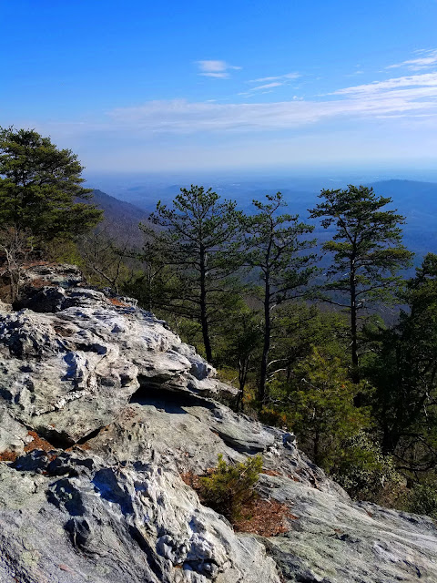
At around two miles we summited the Second Sister, then half a mile later topped the Third Sister. We walked along a saddle up to a fourth peak (unnamed) and over to a rock outcrop with stunning views of Hanging Rock to the west.

From that turnaround point, we loosely retraced our steps, exploring more rock outcrops with views to the southwest. On the return we also made the short side trip to tag the First Sister (no view). Didn’t see any peeps the whole day.

Joe Miller

Joe shared tips on off-trail sight navigation, and comparing my GAIA track with the GPS of other hikers was a valuable learning exercise for me. I don’t profess to be prepared for solo tripping off-trail everywhere, but I think I could repeat this hike in similar (winter) conditions using the track I made.

New area, new skills, winter views and solitude – it doesn’t get any better than that. I drove home with a big ol’ smile on my face.

I repeat: Do yourself a favor and check out GetGoingNC, especially the blog posts and archives. Joe is based in the North Carolina Triangle (Raleigh-Durham-Chapel Hill) but he offers guided hikes in a broader area, and his guided backpacking trips (for beginners as well as experienced folks) are the best you can get for skill building and exposure to some great areas in the NC mountains and beyond. 

“I have discovered in life that there are ways
 of getting almost anywhere you want to go,
if you really want to go.”
~Langston Hughes