Friday, January 28, 2011

A Day Of Bluffing It

MST – Day 38 - 10/21/10 –Highway 18 Freeborne Hotel to Devil’s Garden Overlook – 14 Miles

We could have slept in a little, but for some reason the idea of getting up and walking rather than driving to a trailhead had us up before dawn, lacing up boots and eating our makeshift breakfast. Imagine – the first footstep is progress! Laurel Springs was quiet as we walked east along Miller Road, watching the sky lighten up. We crossed the Blue Ridge Parkway and melted into the woods.

The first few miles were the usual mishmash of trails, fire roads and Parkway crossings, rural scenes and natural wonders aplenty:

Part of the "Quilt Trail" in western North Carolina


I liked the vines twisting around the fence post like a bad hair day


Is this larger than life size? Can't remember...


On every hike I see at least one majestic old tree and I stop to say hello to it in honor of my friend Judy "Heartfire" who loves to hug trees.


After the Basin Cove Overlook the Mountains-to-Sea Trail connects with the Bluff Mountain Trail, part of the Doughton Park trail system. I noticed that Scot’s notes were missing a few items today – he didn’t note every stile that we climbed. With such meticulous detail before, why were these not included? Was he trying to fit all the notes for today’s section on one page? Or did he think a stile was so obvious that he didn’t need to say anything? He always notes creek crossings (also obvious) but perhaps that is for the hiker to plan for water refills. I let this bug me for a while, but eventually had to let it go because “it is what it is.”
 
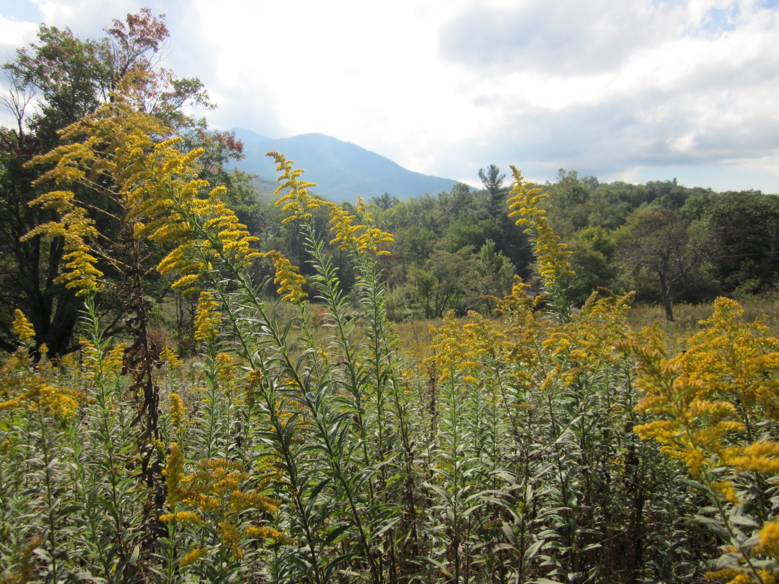
Is it possible that the fall color was even more vibrant than yesterday? Yes!
The MST passes along the lower edge of the retaining wall for the Bluff Mountain Overlook. People taking in the view from their cars couldn’t even see Danny and me as we walked beneath them. We agreed that we were both purposeful and lucky:  feeling good with strong legs and light packs, enjoying the warm sunshine and the spectacular view. How many lives could be changed by having this experience? Come on, people, get outside and get moving!

At the Alligator Back Overlook we started a steep climb up to a rock outcrop. Was this Bluff Mountain? No, keep going. The trail descended through open fields of waist-high grass cut with wide paths. After a brief detour up a side path we saw the picnic/parking area we intended to cross and backtracked. Was this Bluff Mountain? No, keep going. I was on high alert for Scot’s note of “restrooms on left” but the mileage seemed off. Distance is deceiving in open areas! Finally we crossed Bluff Mountain with its lone tree on the summit.
 
 Bluffs Lodge in Doughton Park – Jim and I stayed here during his BRP bike ride in May of 2009


We crossed the Parkway again to the parking lot for the Bluffs Coffee Shop, reknowned for its fried chicken dinners and its long-serving wait staff. Missing out on our breakfast was rectified with a delicious vegetable plate lunch. This kind of thru-hiking could grow on me.

More inclined to a nap than to more hiking, we left the coffee shop. But where does the MST go from here? Scot says “continue on trail at end of parking lot” but a trail seemed to appear in the woods instead. After stomping around for a few minutes we realized that perhaps we should cross the Parkway and, sure enough, there was the MST sign. Onward!

The trail continued through open fields and crossed the Parkway to enter the Doughton Park campground. Here again we were confused (well, at least I was, Danny felt more confident that we were going in the right direction) when white blazes did not appear and we felt our way through the campground. We crossed the BRP one more time and entered the RV section of the campground. Here were all the blazes!

Entering the woods again, I stepped off the trail for a nature break while Danny continued on ahead. When I caught up the scene seemed a little odd: Danny was sitting on a stump and a woman was sitting on the ground near her. I approached and said hello to the woman and she seemed frightened. Danny explained that she had startled the woman and she sat down to recover. The woman said to me that she was on her last hike because she was losing her eyesight. My first thought was, “Are you here alone?” She said, “Yes, but I’m familiar with the area.” She seemed rattled and I didn’t quiz her further – I figured Danny had already talked to her and I would just be repeating questions. The woman stood up and we watched her continue on the trail back towards the parking lot, but she was reaching out to grab tree trunks to steady herself. Was this woman driving? What was our responsibility? As she walked out of sight, I recalled that we had seen a young mother playing with a child at the parking lot a few minutes earlier. Hopefully she knew the woman or would see her and help her. Danny and I continued on our way.

The next landmark on today’s hike was the Brinegar Cabin, built in the 1880’s by Martin Brinegar and occupied by him, his wife and three children until the 1930’s. The cabin is on the National Register of Historic Places. Danny and I emerged from the woods into the parking area where people were stretching their legs, but few ventured all the way down to the cabin – which isn’t far, folks, maybe a tenth of a mile round trip. Both Danny and I had previously visited the cabin but we still checked out the grounds and admired the grand view that this humble family had from their back door. Don’t take anything for granted!

The remainder of the hike carried us across open fields. In the distance I was surprised to pick out Table Rock and Hawksbill, very distinctive formations sticking up like a cat's ears that I thought would be too far away to see. Up one last climb and we were deposited at the Devils’ Garden Overlook. I made a mental note that my book club gals would love the section from Basin Cove Overlook to the Brinegar Cabin – I’ll have to get them on the trail up there come spring.

Danny’s blog for the day is here. An article that Danny contributed to National Parks Traveler about Doughton Park is here.  

I can't say as ever I was lost, but I was bewildered once for three days. ~Daniel Boone

Tuesday, January 25, 2011

Freeborne Party Animals

MST – 10/20/10 – Highway 16 to Highway 18 – Freeborne Hotel – 15.2 Miles

Let’s try a new twist on the Mountains-to-Sea Trail: an overnight backpacking trip with a motel stay. We’ll save some drive time and see how what’s happening in Laurel Springs, NC on a Wednesday night.

Danny and I accepted an invitation from B Townes, a board member of the Friends of the MST, to stay at his home before beginning our backpack. He is an avid hiker, completed an AT thru-hike with his son, and is a trail builder for the MST. B is a mover and shaker with a myriad of connections in his town of Wilkesboro and far beyond. He proudly showed us Camp Harrison, a very impressive YMCA resident camp facility, which he was instrumental in creating and continues to support. We enjoyed a delicious venison dinner that he prepared as we talked about hiking adventures near and far.

I fretted over whether to stuff my usual daypack for the overnighter or carry my weekend pack loosely filled (but heavier). Finally I went with overstuffing the smaller one and it worked out well. You can’t always assume that your pack will be lighter after a day or two – it may be heavier because everything has gotten wet.

And so…we woke to a rainy morning and a dark drizzly drive thru the town’s school rush hour and up Highway 16 to our trailhead. I parked my car on the shoulder of the Blue Ridge Parkway for the next two days (we had placed Danny’s at the far end the day before) and hoped no one would bother it. And yet again we set foot on the MST.

View from Jumpinoff Rock Overlook - not much to see this morning
Scot’s pages were essential today as we changed frequently from trail to old road to open fields, crisscrossing the Parkway. The distance between white blazes was varied but mostly adequate. We passed the Northwest Trading Post via a rather silly roundabout route. We could have easily walked through the parking lot. Danny made an observation that I had not thought of - we don’t know what political workings go into trail routing. There must have been a reason for the trail to go the way it did to avoid the store’s property boundaries.
Creatures great
And small
By mid-day the rain was a memory and blue sky took over, lighting up the changing leaves. People drive on the Parkway and stop at overlooks to peer down at the leaves (from their car windows) but we are walking in the colors.
At our feet
By our sides
Over our heads
Spectacular countryside emerges
Postcard
Frasier magnolias are my favorites because of their color variations – light green to yellow-green to pale yellow to light brown tobacco-colored leaves.
We passed the Sheets Cemetery but didn't go in
A highlight of the walk was the Jesse Sheets cabin, easily missed when traveling by car
The trail bypasses this bridge rather than going across it

At the end of the long last mile we reached Highway 18 and walked down to our home for the night, the Freeborne Hotel in Laurel Springs. I admit that my expectations were low (a roadside motel that caters to motorcycles so I did not anticipate a quiet night). BUT my skepticism was proven wrong. We had a nice simple room, good beds, hot water and a good shower, and ample space to dry out our wet clothing. Our reservation was unnecessary – I think we were the only guests.

Very disappointing, however, to find that the breakfast restaurant promised on the website was no longer operating. We had not counted on that, so we went in search of food. There was little to offer at the store across the street: Lance crackers, Slim Jims, a banana nut muffin that I snagged, and Danny spotted biscotti. These finds were enough to supplement what we were carrying so we would not starve. Don’t count this as a good resupply point, though.

Redemption: the bar/restaurant did serve dinner and it was amazingly good – homemade tomato basil soup, zucchini and squash, garlic mashed potatoes and smothered chicken. I could not eat it all, even knowing I would wish for it the next day. The staff was gracious and smiling.

And imagine our luck - live music on Wednesdays nights! Somebody’s cousin, I think, played guitar and sang for the hometown folks at the bar. There were rounds of applause for Folsom Prison Blues and other favorites. Danny, a country music fan, was grinning from ear to ear. I sat like a fully stuffed bear while she roamed around the bar, videotaping the crowd and plunking her last quarter into a game machine. At something like 8:30 I finally had to go to bed, leaving her to enjoy the party. We had a full day: rain and dripping trees, sunshine and beautiful fall colors, wild animals and socializing humans. And tomorrow is another day on the MST.
Here is Danny's story and she's sticking to it.

Even if something is left undone, everyone must take time to sit still and watch the leaves turn. ~Elizabeth Lawrence

Wednesday, January 19, 2011

The Water Is Wide

MST – Day 36 – 10/14/10 – Old NC 105 (Kestler Memorial HWY) to Blue Blaze Trail for Wolf Pit Road…and Back – 6.8 Miles

So let’s review: Danny and I have hiked over 480 miles of the Mountains-to-Sea Trail from Clingmans Dome in the Great Smoky Mountains to Highway 321 in Blowing Rock, NC…with one small segment missing through which flows the Linville River. We’ve tried twice to hike this section and had to cancel. Now we’ve been all around it and we won’t be near it again for any other hiking. It’s like a sore tooth that you keep probing: how can we get this fixed? It’s only 3.4 miles, for Pete’s sake. Forget about getting other people to hike it with us now. We just wanted to git ‘er done before the weather turned cold. We would just have to make the safety decision about crossing the river when we got to it.

Planning an out-and-back hike rather than a shuttle, we picked a day, the forecast be damned, and left a car at the Forest Service Office for Pisgah National Forest, Grandfather Mountain District. (The staff there was less than enthusiastic about two people actually “hiking” in the national forest, as if it were a very undesirable concept.)

And what a spectacular day we had! The 40% rain forecast did not materialize (don’t ever let the weatherman tell you what to do) and we enjoyed blue skies, popping fall colors and a surprising river crossing.

At the trailhead we met this fine young man out exercising his hunting dogs (driving his truck with them chained and running along behind). This is also the trailhead where we ended our epic thirst-fest hike up and over Bald Knob, one of the most challenging hikes we’ve had.

About a quarter mile after our start we passed the rock outcropping called the Pinnacle. We checked out the view from the platform and kept on going – plenty of time to climb up the rocks on the way back if we survive the river crossing. The descent was steep and stunning.


There’s Shortoff Mountain! We were walking on top of it a couple of weeks ago, but we sure couldn’t see across to the other side.


Colors emerging


And there she was, the good old Linville River, as placid as can be, very wide with a few small ripples, but very clear so we could see the flat bottom and gauge the depth.

Danny and I swapped cameras to photograph each other and she plunged in first – oops, don’t step in that one muddy place. I watched her cross easily with water not reaching her knees and then it was my turn. The shock of cold water never came. It was a perfect temperature. I splashed across, laughing at the absurdity of all our scheming and agonizing. And guess what?? We get to do it again!
It's a long way from here to there

Watch your step here


Come on in, the water's fine!

The MST continues up the eastern side of Linville Gorge to connect with the blue blaze trail to Wolf Pit Road. We tagged up and walked back down to the water for a repeat performance. This time across we carried our own cameras. I stopped midstream to take photos of the mountains. This is one of my most cherished memories of our MST adventure, standing in the middle of the Linville River on a warm, sunny October day: priceless.
Backtracking, we checked out a streamside campsite we had rushed by. Some thoughtful person left lounging chairs.

The climb back up the western side of the Gorge to the Pinnacle is one of the steepest of the whole MST experience, straight up with no switchbacks until very near the top. It was necessary to pause often to admire the changing fall colors, which were just beginning at the bottom but in full riot mode near the top. (Yes, it was the same trail we went down, but somehow the elevation changed.)


At the Pinnacle the wind was picking up and the clouds were rolling in – our timing was perfect. Here we met hikers with a big shaggy black dog that looked very much like a bear. They had a very small orange tag tied on him, supposedly for hunters. (I’m thinking the hunters would never see it.) They took a couple of quick photos of us to mark our triumph over the Linville Gorge. Such an outstanding day: We filled in the gap and conquered Linville Gorge and it was FUN! That’s what I’m talkin’ about!

Read Danny's story for today here.

“Today was good. Today was fun. Tomorrow is another one.” ~ Dr. Seuss

Thursday, January 13, 2011

From Ladders To Carriage Roads

MST – Day 35 – 9/29/10 – Holloway Road to Highway 321 - 13.8 Miles

Today’s hike encompasses two section highlights for me: the Boone Fork Trail and Moses Cone Memorial Park. But first we had to knock out the last couple of miles of the Tanawha Trail.

We finished at Holloway Road yesterday because Danny and I could not picture clearly where the Tanawha Trail links with the Boone Fork Trail – the best we know is that the joining point is somewhere near (in?) Julian Price Park. Early in the morning we started off, back to Holloway Road, through another stile into head-high grasses, clutching Scot Ward’s pages. We no longer had a map and we knew that the trail would switch often between old road beds, new trail and pasture land.

First read Danny’s blog entry here to get some background on Moses Cone Memorial Park. Also, check out her Blowing Rock hikes website page and then buy her book.


Apple trees planted by long-gone residents are still producing


The MST circles and Tanawha feathers led us easily to the junction and we turned our attention to the Boone Fork Trail.


Several years ago I hiked the loop from the Julian Price Park picnic area that includes Boone Fork, a moderate five-miler that offers the excitement of water, bridges, boulders and a ladder.


For Danny and me the thrill factor was kicked up a notch by crossing Boone Fork. It is a very big crossing and I had brought my Crocs, but the challenge of rock hopping is one of my favorite things. Someday Danny will get to say “I told you so” when I get wet but today I triumphed. Immediately on the far side is a great campsite and we took a few minutes to eat and chill.


After Boone Fork the trail makes some moderate climbs. We crossed a forest road or two, climbed over a stile, and came to Rich Mountain Trail, one of the carriage roads in Moses Cone Park. I was slightly disoriented, thinking that we would walk on this trail past the Flat Top fire tower. [Back on a sunny day in April 2007 I hiked up to the fire tower while Jim rode the parkway on his bike – we were each testing our limits for our future “50” projects. But my hike then was on the Flat Top Trail, not Rich Mountain.] Today we descended on the Rich Mountain Trail back towards Moses Cone Manor, switching to other carriage roads and crossing Trout Lake Dam before passing underneath the Blue Ridge Parkway and circling back to the centerpiece of the park, Cone Manor.

One point of interest: on an eye level rock ledge beside the path was a curious collection of small items, a piece of glass, a hair clip, a berry, a flower, a piece of candy, a still life arrangement from which great stories could be created. The display reminded me of a Girl Scout camp tradition called Terebithia, a magical kingdom where fairies (older Scouts) build tiny houses and playgrounds for mortals to see (younger Scouts). Traditions and stories are important in Girl Scouting…and in the hiking world too.


We met other hikers and horse riders as the clouds came in and drizzling rain began. By the time we reached Cone Manor visibility was very limited – no great photos of the view that the house normally commands. We took another break at the restrooms nearby and chatted with a couple there who were familiar with the MST.

The remainder of the hike was uneventful, a slow downhill saunter on yet another gravel carriage road. The carriage road ended and we turned right onto Old Camp Catawba Road. A few minutes later we stood facing the four lanes of busy traffic of Highway 321. Seems there should be some safer and saner way to tie this section of the trail into the next one (not yet completed). But for now there is no choice but a mad dash across to Danny’s car. We were finished for another day and it was time to head home.

Earth and sky, woods and fields, lakes and rivers, the mountain and the sea, are excellent schoolmasters, and teach some of us more than we can ever learn from books. ~John Lubbock

Tuesday, January 11, 2011

The Tanawha Trail

MST – Day 34 – 9/28/10 – Beacon Heights to Holloway Road – 11.5 Miles

Rain or shine? Doesn’t matter, we’re hiking anyway. But now the venue moves far away from our cozy cabin alongside Linville Gorge, so we are up early, cleaning up and locking the door and heading towards Grandfather Mountain. Today we will walk right off the NatGeo map on the long-anticipated Tanawha Trail that runs concurrently with the Mountains-to-Sea Trail and spend the night in Blowing Rock.

I’ve hiked a short section of the Tanawha previously with my son Brett. Danny is familiar with the entire trail and features a particularly stellar section of it in her book, Hiking North Carolina’s Blue Ridge Heritage, along with a brief history of the trail. Will it be spectacular today or will it be an elusive white-out like Linville Gorge? As we drove to arrange the car shuttle, the wind blew fiercely and clouds shrouded the Parkway. Lynn Cove Viaduct? Couldn’t see a thing. But by the time we arrived back at our starting point (Beacon Heights) the blue sky had broken through. For the first couple of hours on the trail the wind continued to blow hard, pushing the clouds up and over the mountains.  

The Parkway is right above us


 Always take advantage of a restroom. At the Lynn Cove Visitor Center we had a quick snack. They had a copy of Danny’s book so she signed it. A few minutes later a couple came in looking for trail information, so the clerk sold the book to them and Danny personalized it. Timing is everything.  

Walking underneath the viaduct is awesome.


House-sized boulders, lots of scrambling around, but I look a little sleepy


Impressive stone step work by trail builders


Slow going up to Rough Ridge, but the reward for our trail choice – a stellar blue sky with a white cloud outlining Grand- father’s profile.


A classic shot of the Lynn Cove Viaduct and a tinge of fall color - look very closely at the far left and you can see the tower on Grand- mother Mountain

What better place for a “first lunch”? Still windy so we didn’t overstay, but we took the time for photos from different vantage points. We encountered other hikers coming up the approach trail from the Rough Ridge parking area. Even if you’re “not a hiker” the short but steep walk up to Rough Ridge is worth the effort. According to Randy Johnson in his book, Hiking North Carolina: “This may be the easiest Parkway path to an awesome view.” As we started our descent, Danny commented that we will never be at such high elevation again on our Mountains-to-Sea adventure. I was thrilled that we had such spectacular views since we missed so much the day before.

But it’s not over yet. The second half of our hike was mild, an easy trail, and we made up some time. To my surprise, the last mile opened up to pastures and friendly cows. One thing the MST guarantees is variety!
I cannot resist a fun fungi photo


Danny coming through a stile bearing the MST white circle blaze and the Tanawha Trail white feather blaze


Seeing double?


Another admirer for Danny


Once again, timing is everything: as we were putting our stuff into my car at the hike’s end, a car drove by, slowed down, and the woman passenger looked at Danny and exclaimed, “You’re the woman who wrote the book!” She and her husband jumped out, produced their copy of Danny’s book, and chatted up a storm while Danny personalized it. I think I’ll get a badge that says, “I’m With Her” – haha! Seriously, though, I am always pleased to see people that have Danny’s books because they are complimentary and excited – they think her hiking guides are great and I do too.

 Next we searched for the terminus of the following day’s hike, then checked into our Blowing Rock hotel and had dinner at Knight’s On Main. Danny tried to talk to me about future hike plans but I had mentally checked out. I’ve concluded that 3 days, 3 nights is my maximum before thoughts and responsibilities from other aspects of my life creep back in. We’ve got one more hike to go for this leg and then it’s back to everyday life.
Read Danny's blog about the day here.
Sweet the rain's new fall, sunlit from heaven
Like the first dewfall on the first day...
Praise with elation, praise every morning
God's re-creation of the new day ~ Cat Stevens, "Morning Has Broken"